Category:Old maps of Putumayo Department
Jump to navigation
Jump to search
Media in category "Old maps of Putumayo Department"
The following 4 files are in this category, out of 4 total.
-
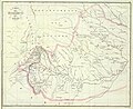
 Carta Corográfica de la parte oriental i ménos poblada Del Estado Del Cauca.jpg 12,908 × 9,745; 12.63 MB
-
 Carta del Departamento de Azuay.jpg 6,795 × 5,548; 12.73 MB
-
 Carta del Departamento del Cauca.jpg 4,361 × 6,129; 7.25 MB
-
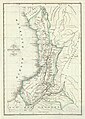
 Mapa del Territorio del Caquetá (1865).jpg 1,477 × 1,015; 282 KB


.jpg)