Category:Old maps of Punjab, Pakistan
Jump to navigation
Jump to search
Subcategories
This category has the following 3 subcategories, out of 3 total.
Media in category "Old maps of Punjab, Pakistan"
The following 35 files are in this category, out of 35 total.
-

-
 1965 War Sketch.jpg 960 × 720; 104 KB
-

-
 Major ethnic groups of Pakistan in 1980 borders removed.jpg 960 × 928; 182 KB
-

-

-

-

-

-

-
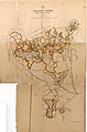
 Map of the country of the Sikhs (Punjab), surveyed by Lt. Rind, 1786 (F.4-25).jpg 9,148 × 6,450; 5.49 MB
-
 Map of the Northern Part of the Punjab and of Kashmir in 1846, by John Walker.jpg 6,418 × 9,181; 12.77 MB
-
-
 Map of the Punjab and adjoining country, drawn by Abdul Haleem in 1850 (F07-17-A).jpg 15,536 × 6,582; 7.44 MB
-
 Map of the Punjab and protected Sikh states, including Gulab Singh's territory, 1842 (F.4-32-1).jpg 14,781 × 12,005; 12.07 MB
-
 Map of the Punjab and protected Sikh states, including Gulab Singh's territory, 1842 (F.4-32-2).jpg 11,136 × 12,402; 9.82 MB
-
 Map of the Punjab and protected Sikh states, including Gulab Singh's territory, 1842 (F.4-32-3).jpg 16,768 × 9,975; 10.48 MB
-

-
 Map of the Punjab and Protected Sikh States, including the British Provinces to the South, 1846.jpg 12,202 × 11,854; 12.66 MB
-
 Map of the Punjab and the adjoining countries, 1853 (F.4-10).jpg 12,406 × 13,462; 18.06 MB
-
 Map of the Punjab in eight sections, drawn by Hussain Ali, 1865 (sheet 1 of 8) (F.4-20).jpg 12,282 × 7,600; 7.07 MB
-
 Map of the Punjab in eight sections, drawn by Hussain Ali, 1865 (sheet 2 of 8) (F.4-19).jpg 12,062 × 7,575; 9.64 MB
-
 Map of the Punjab in eight sections, drawn by Hussain Ali, 1865 (sheet 3 of 8) (F.4-18).jpg 12,269 × 7,487; 8.46 MB
-
 Map of the Punjab in eight sections, drawn by Hussain Ali, 1865 (sheet 7 of 8) (F.4-14).jpg 13,032 × 7,341; 12.06 MB
-

-

-
 Map of the Punjab in eight sections, drawn by Hussain Ali, 1866 (sheet 4 of 8) (F.4-17).jpg 13,312 × 8,827; 8.52 MB
-
 Map of the Punjab in eight sections, drawn by Hussain Ali, 1867 (sheet 8 of 8) (F.4-13).jpg 12,275 × 7,534; 10.76 MB
-
 Map of the Punjab in eight sections, drawn by Hussain Ali, 1868 (sheet 5 of 8) (F.4-16).jpg 12,192 × 7,691; 9.88 MB
-
 Map of the Punjab in eight sections, drawn by Hussain Ali, 1868 (sheet 6 of 8) (F.4-15).jpg 12,440 × 7,709; 12.25 MB
-

-
 North-West India.jpg 486 × 786; 159 KB
-

-
 Punjab in 1912.jpg 1,409 × 1,895; 658 KB
-

%27_(11095224145).jpg)

.jpg)

.jpg)
_(F.4-21).jpg)
_(F.4-22).jpg)
_(F.4-23).jpg)
_(F.4-24).jpg)
.jpg)
,_surveyed_by_Lt._Rind,_1786_(F.4-25).jpg)


.jpg)
.jpg)
.jpg)
.jpg)
.jpg)

.jpg)
_(F.4-20).jpg)
_(F.4-19).jpg)
_(F.4-18).jpg)
_(F.4-14).jpg)
_(F.4-13_to_F.4-20)_(one).jpg)
_(F.4-13_to_F.4-20)_(two).jpg)
_(F.4-17).jpg)
_(F.4-13).jpg)
_(F.4-16).jpg)
_(F.4-15).jpg)
.jpg)

.jpg)

.jpg)