Category:Old maps of Puerto Rico from the Norman B. Leventhal Map Center
Jump to navigation
Jump to search
Media in category "Old maps of Puerto Rico from the Norman B. Leventhal Map Center"
The following 5 files are in this category, out of 5 total.
-
 1712 detail Porto Rico map by Johannes van Keulen BPL m8719.png 3,052 × 1,059; 6.5 MB
-
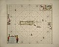 1712 Porto Rico map by Johannes van Keulen BPL m8719.jpg 6,389 × 5,095; 9.72 MB
-

-

-


.jpg)
.jpg)
.jpg)