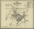
Category:Old maps of Prudnik
Jump to navigation
Jump to search
Media in category "Old maps of Prudnik"
The following 8 files are in this category, out of 8 total.
-
Bundesarchiv Bild 196-05671, Neustadt - Oberschlesien.jpg 783 × 800; 171 KB
-
Granice administracyjne Prudnika, 1880.jpg 898 × 685; 131 KB
-
Plany III wojny slaskiej, bitwa pod Trzebiną.jpg 3,018 × 1,885; 1.29 MB
-
Prudnik plan 1890 (cmentarz).jpg 1,593 × 1,128; 351 KB
-
Prudnik plan 1890.jpg 10,574 × 9,120; 15.44 MB
-
Prudnik plan 1908 (cmentarz).jpg 498 × 331; 50 KB
-
Prudnik plan 1908.jpg 2,436 × 1,856; 1.2 MB
-
Prudnik plan 1929.jpg 1,014 × 1,500; 569 KB


