Category:Old maps of Provence
Jump to navigation
Jump to search
Subcategories
This category has only the following subcategory.
Media in category "Old maps of Provence"
The following 25 files are in this category, out of 25 total.
-

-
 Le Daulphiné, Languedoc, Gascoigne, Provence et Xaintonge - btv1b550046724.jpg 6,964 × 5,277; 4.44 MB
-
 Le Daulphiné, Languedoc, Gascoigne, Provence et Xaintonge - btv1b84464932.jpg 7,896 × 6,216; 9.03 MB
-

-

-

-

-
 1747 La Feuille Map of Provence, France - Geographicus - Provence-ratelband-1747.jpg 2,500 × 1,714; 1.78 MB
-
-
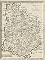
 1771 Bonne Map of Dauphine and Provence, France - Geographicus - Provence-bonne-1771.jpg 2,549 × 3,500; 2.8 MB
-

-
 Carte de Provence et des Terres Adjacentes (MAPS 123).jpg 7,308 × 5,798; 12.6 MB
-
 Carte du Languedoc-Dauphiné-Provence, Delamarche 1794.jpg 3,542 × 3,104; 1.46 MB
-

-
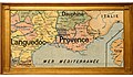
 G. Bruno - Le Tour de la France par deux enfants p180h.jpg 1,008 × 860; 240 KB
-
 Gallia Christiana - Arelatensis - 1715.jpg 6,967 × 5,818; 7.23 MB
-
 Gallia Christiana - Avenionensis - 1715.jpg 7,010 × 5,873; 6.65 MB
-
 Map of France South East (1600).jpg 800 × 600; 152 KB
-
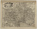
 Map of Provence by Abraham Ortelius.jpeg 3,059 × 2,373; 2.42 MB
-
 Map Provence 1184.jpg 236 × 202; 90 KB
-
 Principat de Montdragon.jpg 1,167 × 977; 739 KB
-
 Provence - Province.jpg 3,600 × 2,100; 1.9 MB
-
 Provence 1628l.jpg 2,364 × 1,674; 1.02 MB
-
 Provence 1715.JPG 2,280 × 1,887; 2.68 MB
-

.jpg)


tat_Venaiscin,_prin(cipau)t%C3%A9_d%27Orange,_Co(m)tat_de_Nice,_etc._-_par_le_Sr_Sanson_d%27Abbeville_-_btv1b8592741r.jpg)
.jpg)


.jpg)

.jpg)
.jpg)


.jpg)


