Category:Old maps of Portsmouth
Jump to navigation
Jump to search
Subcategories
This category has only the following subcategory.
Media in category "Old maps of Portsmouth"
The following 41 files are in this category, out of 41 total.
-

-
 Map of portsmouth a bit before 1540.PNG 1,928 × 1,860; 1.49 MB
-
 1773 map of portsmouth showing the town and dock defences.JPG 1,856 × 2,247; 2.62 MB
-

-
 Portsmouth point OS25 inch to mile1858.PNG 1,480 × 1,266; 3.39 MB
-

-
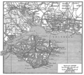
 EW(1884) p.134 - Portsmouth (left) - A + C Black (pub).jpg 1,304 × 1,952; 540 KB
-
 EW(1884) p.135 - Portsmouth (right) - A + C Black (pub).jpg 1,297 × 1,942; 634 KB
-

-

-

-

-
 Portsmouthmap1945.jpg 3,504 × 2,544; 1.63 MB
-

-

-

-

-
 A plan of Portsmouth... - btv1b530105904.jpg 5,970 × 4,545; 4.67 MB
-
 A Plan of the Town and Fortifications of Portsmouth (1725).jpg 4,000 × 3,013; 1.63 MB
-

-
 Admiralty Chart No 1 Portsmouth to Canary Islands, Published 1914.jpg 8,752 × 15,120; 12.56 MB
-
-
 Admiralty Chart No 2675b English Channel. Middle sheet, Plymouth to Portsmouth, Published 1885.jpg 7,961 × 11,800; 28.08 MB
-
 Admiralty Chart No 3418 Langston Harbour, Published 1943.jpg 8,815 × 13,201; 30.88 MB
-
 Bacon's Map of Portsmouth, Portsea, Landport, Southsea and Gosport - btv1b530211067.jpg 10,811 × 7,358; 10.7 MB
-
 EB1911 Portsmouth.jpg 1,016 × 685; 433 KB
-
 Map showing Fortifications of the Island of Portsea, 1773.jpg 4,000 × 3,311; 2.05 MB
-
 Meyers b13 s0249 b1.png 785 × 702; 330 KB
-
 Ordnance Survey Drawings - Portsmouth (OSD 75-3).jpg 4,000 × 3,406; 5.43 MB
-
 Plan de Portsmouth - btv1b53010361k.jpg 6,382 × 4,808; 4.74 MB
-
 Plan of Portsmouth (c.1728).jpg 4,000 × 2,864; 1.46 MB
-
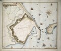
 Plan of the fortifications of the town of Portsmouth (c. 1660-1685).jpg 4,000 × 2,763; 1.56 MB
-
 Plan of the Lines at Portsea-Lake near Portsmouth (W. Dundas, 1757).jpg 4,000 × 2,341; 1.45 MB
-
 Portsmouth Dockyard ca. 1840.jpg 878 × 1,280; 307 KB
-
 Portsmouth RMG F0926.tiff 3,000 × 3,000; 25.75 MB
-
 Portsmouth RMG F1960.tiff 6,555 × 5,454; 102.28 MB
-
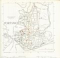 Portsmouth roadmap 1948.jpg 2,550 × 2,464; 594 KB
-
 Portsmouth, Portsea, Landport and Southsea - btv1b8445012x.jpg 7,320 × 8,964; 8.27 MB
-
 Portsmouth. A Perspective View of Portsmouth & Gosport, from St. Helens (c.1710-14).jpg 4,000 × 3,087; 2.8 MB
-
 Whale Island, Hampshire map 1945.jpg 274 × 206; 10 KB
-

%27_(11105267033).jpg)


.jpg)

.jpg)
_p.134_-_Portsmouth_(left)_-_A_%2B_C_Black_(pub).jpg)
_p.135_-_Portsmouth_(right)_-_A_%2B_C_Black_(pub).jpg)
.jpg)
.jpg)
.jpg)
.jpg)

.jpg)


.jpg)
.jpg)


.jpg)

.jpg)
.jpg)
.jpg)


.jpg)

.jpg)