Category:Old maps of Porter County, Indiana
Jump to navigation
Jump to search
Subcategories
This category has the following 5 subcategories, out of 5 total.
Media in category "Old maps of Porter County, Indiana"
The following 11 files are in this category, out of 11 total.
-
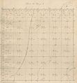 1875 Survey T34 R5.JPG 3,862 × 4,177; 987 KB
-

-

-

-

-

-

-

-
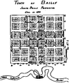 Bailly, Indiana plan 1833.png 1,644 × 1,968; 197 KB
-
 Century of Progress Arch Dist (map).JPG 1,593 × 1,062; 286 KB
-
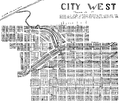 City West, Indiana plan 1837.png 1,166 × 1,000; 200 KB

.jpg)
.jpg)
.jpg)
.jpg)

_-_Porter_County_-_Porter_County_-_ED_64-1_to_42_-_NARA_-_12059862.jpg)
_-_Porter_County_-_Valparaiso_-_ED_64-3_to_17_-_NARA_-_12059864.jpg)

.JPG)
