Category:Old maps of Pingtung
Jump to navigation
Jump to search
中文(臺灣):屏東縣的古地圖
Media in category "Old maps of Pingtung"
The following 28 files are in this category, out of 28 total.
-
Map line between aborigines and hans.jpg 1,735 × 1,133; 1.41 MB
-
1898日治二萬分之一台灣堡圖(明治版).jpg 1,190 × 919; 244 KB
-
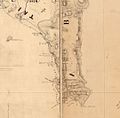
Back front mount Taiwan Hengchun 1879.jpg 1,012 × 759; 672 KB
-
City Plans Heito.jpg 5,151 × 3,966; 4.43 MB
-
City Plans Toko.jpg 3,966 × 3,578; 2.55 MB
-
Formosa Island and the Pescadores Le Gendre Bootang 1870.jpg 1,080 × 1,064; 224 KB
-
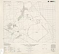
Kato 1 10000 1944.jpg 4,358 × 3,988; 3.16 MB
-
Lambay Insel (Karte 1905).jpg 236 × 256; 25 KB
-
Location map of schools in Takao and Hoko 1927.jpg 783 × 1,200; 184 KB
-
Map of Hengchun county 1880.jpg 5,712 × 4,672; 24.93 MB
-
Map of the Western Coast of Taiwan, Tayouan and Points South, c. 1636.jpg 1,000 × 669; 246 KB
-
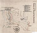
Notes of travel in Formosa 1869.jpg 1,208 × 1,088; 1.15 MB
-
Souther part of Taiwan Le Gendre c1873.jpg 1,082 × 1,554; 1.22 MB
-
〈高砂族分布圖〉(複製品)恆春郡部分 (2).jpg 3,064 × 4,592; 6.82 MB
-
〈高砂族分布圖〉(複製品)潮州郡南部部分.jpg 3,424 × 3,424; 5.66 MB
-
內埔庄管內圖.jpg 2,439 × 2,177; 2.9 MB
-
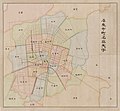
屏東市町名與大字圖.jpg 2,517 × 2,329; 2.61 MB
-
屏東水道水源地位置平面圖.jpg 2,136 × 1,002; 1.06 MB
-
屏東郡管內圖.jpg 5,131 × 3,702; 7.05 MB
-
新埤庄全圖.jpg 4,332 × 3,186; 5.61 MB
-
東港郡管內圖.jpg 1,409 × 2,015; 1.37 MB
-
潮州郡管內圖.jpg 1,305 × 2,011; 1.14 MB
-
潮州郡鳥瞰圖.jpg 4,843 × 2,047; 6.6 MB
-
萬巒庄管內略圖.jpg 2,259 × 2,278; 2.75 MB
-
阿緱街町名區畫.jpg 2,065 × 2,888; 3.53 MB
-
鵝鑾鼻神社位置圖.jpg 1,781 × 2,113; 1.52 MB


