Category:Old maps of Paris 3e arrondissement
Jump to navigation
Jump to search
|
Paris 1 • 2 • 3 • 4 • 5 • 6 • 7 • 8 • 9 • 10 • 11 • 12 • 13 • 14 • 15 • 16 • 17 • 18 • 19 • 20 |
| NO WIKIDATA ID FOUND! Search for Old maps of Paris 3e arrondissement on Wikidata | |
| Upload media |
Subcategories
This category has only the following subcategory.
Media in category "Old maps of Paris 3e arrondissement"
The following 15 files are in this category, out of 15 total.
-

-

-
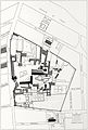
 Le Temple, 1450-1770.jpg 3,566 × 2,970; 5.83 MB
-
 Le Temple, 1450.jpg 1,639 × 2,437; 2.02 MB
-
 Le Temple, 1770.jpg 1,641 × 2,440; 2.58 MB
-
 Paris 3e & 4e arrondissement - Eugène Andriveau-Goujon.jpg 5,304 × 3,978; 8.59 MB
-
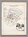
 Paris 3e arrondissement - Eugène Andriveau-Goujon.jpg 2,809 × 3,546; 3.59 MB
-
 Paris-atlas by Fernand Bournon - 12. 3e arrondissement - David Rumsey.jpg 4,577 × 5,957; 24.3 MB
-
 Paris.carte d'arrondissement.A03.jpg 1,298 × 1,060; 479 KB
-
 Petit atlas pittoresque - 15. 3e arrondissement - Quartier Montmartre. No. 10 - David Rumsey.jpg 6,448 × 8,642; 15.48 MB
-
-

-
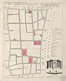
 Petit atlas pittoresque 11 - 3e arrondissement, n° 10, quartier Montmartre - BHVP.jpg 3,201 × 4,001; 2.64 MB
-

-
 Petit atlas pittoresque 27 - 7e arrondissement, n° 26, quartier du Mont-de-Piété - BHVP.jpg 3,185 × 3,918; 2.38 MB


