Category:Old maps of Newcastle upon Tyne
Jump to navigation
Jump to search
Subcategories
This category has the following 2 subcategories, out of 2 total.
Media in category "Old maps of Newcastle upon Tyne"
The following 21 files are in this category, out of 21 total.
-
 The River of Tyne leading from the Sea on the east, to Newcastle... (BM Q,6.125).jpg 2,500 × 2,078; 1.02 MB
-
 1836 map of Grainger's railway termini proposal for Newcastle.jpeg 1,280 × 1,584; 1.04 MB
-
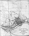
 Newcastle 1844.png 626 × 507; 239 KB
-
 Bedlingtonshire, from Betts's Family Atlas, 1846.jpg 750 × 940; 1.16 MB
-

-
 EW(1884) p.556 - Newcastle upon Tyne and Gateshead (left) - A + C Black (pub).jpg 1,225 × 1,902; 728 KB
-
 EW(1884) p.557 - Newcastle upon Tyne and Gateshead (right) - A + C Black (pub).jpg 1,225 × 1,902; 819 KB
-

-

-
-

-
 193 of 'The International Geography. ... Edited by H. R. Mill' (11165407963).jpg 1,400 × 480; 239 KB
-

-

-
 Admiralty Chart No 3258 River Tyne Jarrow Slake to Elswick, Published 1902.jpg 11,052 × 8,126; 32.06 MB
-
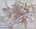
 History of Newcastle and Gateshead (1884) (14780106831).jpg 1,826 × 1,842; 477 KB
-

-

-

-

-
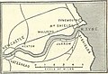
 Proposed 1834 Plan Newcastle to North Shields Railway Tracts vol 57 p298 crop js.jpg 1,781 × 1,010; 806 KB
.jpg)


.jpg)
_p.556_-_Newcastle_upon_Tyne_and_Gateshead_(left)_-_A_%2B_C_Black_(pub).jpg)
_p.557_-_Newcastle_upon_Tyne_and_Gateshead_(right)_-_A_%2B_C_Black_(pub).jpg)
.jpg)
.jpg)
.jpg)
.jpg)

_(14780106831).jpg)
.jpg)


_G._Collins_hydro(grap)h_to_the_King_;_H._Moll..._-_btv1b10678788s.jpg)

.jpg)
_Edited_by_E._G._Ravenstein_..._Illustrated,_etc%27_(11188759373).jpg)
.jpg)