Category:Old maps of New South Wales
Jump to navigation
Jump to search
Subcategories
This category has the following 3 subcategories, out of 3 total.
Media in category "Old maps of New South Wales"
The following 55 files are in this category, out of 55 total.
-
1365 - Mayfield - SHR Plan No 2965 (5051475b100).jpg 707 × 1,000; 357 KB
-
15 of 'The Jenolian Caves and the Blue Mountains. By Argus' (11249111193).jpg 1,944 × 1,986; 571 KB
-
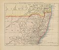
48 of 'Overland from Southampton to Queensland. (With maps.)' (11075640506).jpg 3,457 × 2,939; 2.06 MB
-
503 of 'Physical description of New South Wales and Van Diemen's land' (11023491174).jpg 1,442 × 2,343; 336 KB
-
Australia21.jpg 2,952 × 5,008; 1.58 MB
-
Berrima map.jpg 600 × 447; 108 KB
-
Endeavour River etc. accountofvoyages03hawk 0098.jpg 3,532 × 1,700; 816 KB
-
Government Paddocks Old Botany Road and Parramatta Street (13768250975).jpg 1,539 × 2,000; 1.93 MB
-
HUndred of Windsor.png 700 × 584; 716 KB
-
Journal and proceedings of the Royal Society of New South Wales (1913) (14776183021).jpg 1,700 × 2,484; 510 KB
-
Map of New South Wales - btv1b8445373n.jpg 11,190 × 8,914; 13.19 MB
-
Map of New South Wales as occupied by the native tribes.jpg 2,000 × 1,750; 834 KB
-
Map of New South Wales, shewing land districts, 1881 - btv1b530210380.jpg 9,288 × 7,603; 8.09 MB
-
Map of New-South-Wales, showing rabbitproof fonces - btv1b530280229.jpg 10,956 × 9,266; 16.34 MB
-
Map of New-South-Wales... - btv1b530653055.jpg 8,656 × 7,136; 6.13 MB
-
Map of the Blue Mountains (8703552652).jpg 2,255 × 1,500; 2.99 MB
-
Meyer‘s Zeitungsatlas 015 – Asiatischer Archipel und Neu-Holland.jpg 7,385 × 6,224; 16.66 MB
-
Modern Asia (1796).tif 1,024 × 1,287; 3.77 MB
-
MT-McDonald-showing-Markhams-Creek.png 500 × 305; 217 KB
-
New South Wales accountofvoyages03hawk 0092.jpg 3,533 × 1,729; 308 KB
-
Old parish map of New Mountain Rush.tif 3,838 × 2,528; 27.82 MB
-
Sketch shewing the fords near Penrith (13899776878).jpg 1,000 × 1,229; 1.07 MB
-
Sketch shewing the reserve for the extension of Sydney (NSW) (13768252095).jpg 1,878 × 2,000; 2.4 MB
-
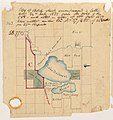
Surveyor General's Sketch books, Reserve and land south of Lake Bathurst (13612577054).jpg 1,500 × 1,588; 1.55 MB
-
The City of Sydney.jpg 4,100 × 2,944; 7.84 MB


