Category:Old maps of Neuwerk
Jump to navigation
Jump to search
Use the appropriate category for maps showing all or a large part of Neuwerk. See subcategories for smaller areas:
| If the map shows | Category to use |
|---|---|
| Neuwerk on a recently created map | Category:Maps of Neuwerk or its subcategories |
| Neuwerk on a map created more than 70 years ago | Category:Old maps of Neuwerk or its subcategories |
| the history of Neuwerk on a recently created map | Category:Maps of the history of Neuwerk or its subcategories |
| the history of Neuwerk on a map created more than 70 years ago | Category:Old maps of the history of Neuwerk or its subcategories |
Subcategories
This category has the following 5 subcategories, out of 5 total.
1
Media in category "Old maps of Neuwerk"
The following 30 files are in this category, out of 30 total.
-
 De Nordseeküste (Karten) 05.jpg 6,182 × 4,412; 3.88 MB
-
 Bremen-Verden1655.jpg 1,644 × 1,398; 3.14 MB
-
 Jacobus-Schuback-Commentarius-de-jure-littoris MG 0949.tif 4,644 × 3,551; 47.21 MB
-
 Jacobus-Schuback-Commentarius-de-jure-littoris MG 0952.tif 3,947 × 3,564; 40.28 MB
-
 Reilly 303.jpg 1,540 × 832; 524 KB
-
 PPN612024377 Das Gebieth Der Stadt Hamburg Mit Den Angrenzenden Landen (1811).jpg 6,429 × 7,219; 7.74 MB
-
 PPN612024377 Das Gebieth Der Stadt Hamburg Mit Den Angrenzenden Landen (1811).tif 6,948 × 7,253; 20.31 MB
-

-

-
 PPN611998394 Karte für die Einsegelung in die Elbe (1868).jpg 9,726 × 7,948; 13.9 MB
-
 PPN611998394 Karte für die Einsegelung in die Elbe (1868).tif 10,308 × 8,128; 30.47 MB
-
 PPN612044777 Das Hamburger Gebiet und dessen Umgegend (1871).jpg 10,170 × 7,883; 18.81 MB
-
 PPN612044777 Das Hamburger Gebiet und dessen Umgegend (1871).tif 10,562 × 7,961; 45.68 MB
-
 Zeekaart van de Noordzee uit 1883.jpg 4,733 × 2,740; 3.61 MB
-

-

-
 Caerte van Oostlant 4MB.jpg 7,040 × 5,300; 3.84 MB
-
 Cuxhaven.png 618 × 528; 215 KB
-
 Elbe weser mündung.jpg 4,572 × 3,956; 6.37 MB
-
 GK25 (Neue Nr. 2016 2017 2117) Altenwalde, Insel Neuwerk u. Insel Scharhörn, Geologische Karte.jpg 11,233 × 10,715; 40.04 MB
-
 Insel Neuwerk um 1900.jpg 1,040 × 1,640; 1.02 MB
-
 JBAM 074b.JPG 3,248 × 2,480; 5.07 MB
-
-
 Lange diercke sachsen deutsche landschaften wattenkueste.jpg 1,235 × 2,057; 1.14 MB
-
 Map elbe mouth 1910.jpg 1,500 × 927; 787 KB
-
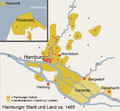 Map Hamburg Area 1500.png 854 × 792; 149 KB
-
 Ostfriesland1881.JPG 13,211 × 8,217; 48.87 MB
-
 Pincerno - Niederelbe 1860.jpg 1,191 × 842; 315 KB
-
 Zimmermann Hasenbanck Elbmündung 1721 Peilungen Neuwerk.png 784 × 514; 1,003 KB
-
 Zimmermann Hasenbanck Elbmündung 1721.jpg 5,523 × 3,357; 17.91 MB
_05.jpg)


.jpg)
.jpg)
.jpg)
.jpg)


_Altenwalde,_Insel_Neuwerk_u._Insel_Scharh%C3%B6rn,_Geologische_Karte.jpg)


