Category:Old maps of Nara
Jump to navigation
Jump to search
Subcategories
This category has the following 12 subcategories, out of 12 total.
K
- KagekiyoJizo Nara (6 F)
- Kasuga-Jingu Houses Map (5 F)
- Kawarado Shibai Nara (4 F)
- Kikaigashima Nara (5 F)
N
- Nara City Accurate Map 1964 (3 F)
- Nara Sight Seeing Map 1936 (3 F)
- Nara Survey Map 1896 (1 F)
- Nara Survey Map 1909 (2 F)
S
- Sightseeing Map of Nara (3 F)
Media in category "Old maps of Nara"
The following 11 files are in this category, out of 11 total.
-
 Nara Detail Map 1908.jpg 9,998 × 7,144; 44.49 MB
-
 Nara Enjoying Map 1965.jpg 4,798 × 3,356; 6.6 MB
-
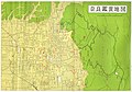
 Nara Famous Sightseeing Place Map 1941.jpg 2,436 × 1,740; 1.69 MB
-
 Nara map of 1742.png 1,746 × 1,255; 2.89 MB
-
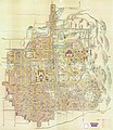
 Nara shigai meiku kosekizu.jpg 5,284 × 4,012; 12.82 MB
-
 Nara Sightseeing Map 1953.jpg 1,536 × 2,160; 1.3 MB
-
 Nara, Japan (709-784).jpg 9,618 × 6,804; 16.97 MB
-
 Naramachi Map Yasui Collection.jpg 14,132 × 16,353; 99.06 MB
-
 Plan of Nara, Yamato Province.jpg 2,500 × 1,933; 2.14 MB
-
 Washū Nanto no zu 和州南都之図 (1778).jpg 4,452 × 6,538; 18.9 MB
-
 Washū Nara no zu 和州奈良之図.jpg 8,147 × 6,196; 28.29 MB


.jpg)


.jpg)
