Category:Old maps of Nantucket
Jump to navigation
Jump to search
Subcategories
This category has the following 3 subcategories, out of 3 total.
- 18th-century maps of Nantucket (18 F)
- 19th-century maps of Nantucket (42 F)
B
Media in category "Old maps of Nantucket"
The following 10 files are in this category, out of 10 total.
-
 The tourist's guide to Nantucket and Martha's Vineyard (1902) (14597311627).jpg 4,236 × 2,570; 1.2 MB
-

-
 Map of Cape Cod and vicinity (2675096300).jpg 1,867 × 2,000; 3.24 MB
-
-
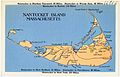 Nantucket Island, Massachusetts (66816).jpg 3,348 × 2,148; 1.95 MB
-

-

-

-

-
 Admiralty Chart No 2489 Nantucket Sound Eastern Part and Approaches, Published 1955.jpg 11,056 × 16,249; 44.99 MB
_(14597311627).jpg)
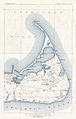
_Wrecks_around_Nantucket_-_Map_of_Nantucket_Island_(14783356743).jpg)
.jpg)

.jpg)


_-_Nantucket_County_-_Nantucket_Town_-_ED_10-1_to_12_-_NARA_-_12549195_(page_1).jpg)
_-_Nantucket_County_-_Nantucket_Town_-_ED_10-1_to_12_-_NARA_-_12549195_(page_2).jpg)
