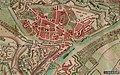
Category:Old maps of Namur (city)
Jump to navigation
Jump to search
Subcategories
This category has the following 3 subcategories, out of 3 total.
M
P
- Plan-relief of Namur (29 F)
Media in category "Old maps of Namur (city)"
The following 33 files are in this category, out of 33 total.
-
 "Namurcum Comitatus - Iohann Surhonio" (22244045122).jpg 3,551 × 2,870; 2.13 MB
-
-
 Mons, Charleroi, Namur, et Louvain - btv1b55006147x (2 of 3).jpg 6,519 × 4,947; 3.47 MB
-
 Plan des attaques du chateau de Namur 1692.jpg 5,976 × 4,056; 3.89 MB
-
 Plan des attaques du chateau de Namur 1692-06-28.jpg 5,388 × 3,564; 2.38 MB
-
 Plan de Namur 1693.jpg 8,024 × 6,986; 6.56 MB
-
 Plan citadelle de Namur 16xx.jpg 5,243 × 7,357; 4.28 MB
-
 Plan Namur 1709 (2).jpg 7,904 × 6,052; 8.15 MB
-
 Plan Namur 1709.jpg 8,640 × 6,694; 7.17 MB
-
 Plan Namur 1710.jpg 10,599 × 6,601; 11.37 MB
-
 Plan Namur 1746.jpg 9,506 × 6,349; 14.59 MB
-
 Plan Namur 17xx.jpg 5,652 × 5,082; 5.11 MB
-

-

-

-
 Aduactisiege.jpg 692 × 550; 129 KB
-
 Belagerung Namur 1695 2.jpg 1,200 × 802; 313 KB
-
 Belagerung von Namur 1695.jpg 285 × 200; 20 KB
-
 Carte de Flawinne vers 1770.jpg 1,715 × 1,600; 637 KB
-
 Coronelli - Mons, Charleroy, Namur, Lewe.jpg 6,519 × 4,947; 3.61 MB
-
 Defences of Namur, 1914.jpg 880 × 696; 206 KB
-
 Ferraris Beaumel.jpg 1,402 × 611; 354 KB
-
 Ferraris Namur avec Berlacomine.jpg 1,449 × 708; 375 KB
-

-
 Namen 1905.jpg 3,463 × 2,378; 3.11 MB
-
 Namur - btv1b53100034h.jpg 10,599 × 6,601; 10.92 MB
-
 Namur 1745.jpg 2,000 × 1,678; 433 KB
-
 Namur, Belgium, Ferraris, 1775.jpg 1,680 × 1,050; 352 KB
-
 Namur, Map by Priorato.JPG 512 × 384; 53 KB
-
 Position fortifiee namur - Vue d'ensemble.jpg 1,500 × 1,100; 510 KB
-
 Siege of Namur 1692.jpg 795 × 551; 161 KB
-

-

.jpg)
_(With_plates.)%27_(11037166055).jpg)
.jpg)


.jpg)


_(With_plates.)%27_(11037367295).jpg)
_(With_plates.)%27_(11035759595).jpg)
.jpg)


.jpg)
.jpg)