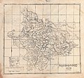
Category:Old maps of Mayurbhanj State
Jump to navigation
Jump to search
Media in category "Old maps of Mayurbhanj State"
The following 8 files are in this category, out of 8 total.
-
Mayurbhanj State 1901.jpg 488 × 390; 301 KB
-
1931, Mayurbhanj state's population density map.jpg 3,639 × 2,730; 5.03 MB
-
1931, Mayurbhanj state's population immigration map.jpg 3,229 × 2,421; 3.46 MB
-
1931, Mayurbhanj state's population literacy map.jpg 3,229 × 2,421; 4.15 MB
-
1931, Mayurbhanj state's population variation map.jpg 3,286 × 2,464; 4.56 MB
-
Mayurbhanj State map 1931.jpg 2,814 × 2,088; 1.46 MB
-
Mayurbhanj state map 1935.jpg 1,978 × 1,832; 2.45 MB
-
Southwest Bengal, 1776, by Rennell.jpg 3,028 × 2,271; 10.25 MB


