Category:Old maps of Lower Lusatia
Jump to navigation
Jump to search
| NO WIKIDATA ID FOUND! Search for Old maps of Lower Lusatia on Wikidata | |
| Upload media |
Subcategories
This category has the following 2 subcategories, out of 2 total.
Media in category "Old maps of Lower Lusatia"
The following 15 files are in this category, out of 15 total.
-
 Tabula Compendia Saxoniae komplett.jpg 3,768 × 2,245; 12.29 MB
-
 Tabula Compendia Saxoniae.jpg 7,257 × 6,007; 58.97 MB
-
 Ernst Muckas Karte der Lausitz (1886).jpg 2,702 × 3,976; 6.99 MB
-
 Země Koruny české.jpg 2,847 × 2,260; 1.11 MB
-

-
 Blaeu 1645 - Saxonia Superior cum Lusatia et Misnia.jpg 3,720 × 3,120; 1.26 MB
-
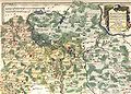
 Das Marggrafthum Nieder-Lausitz.jpg 4,362 × 3,551; 4.24 MB
-

-
 Karte Lausitz 1715.png 7,832 × 5,489; 97.48 MB
-
 Lausitz map 18thC.jpg 1,624 × 1,383; 3.01 MB
-
 Luther region 1519.png 1,119 × 712; 2.3 MB
-
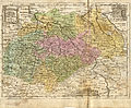
 Reilly 104a.jpg 1,650 × 1,181; 1.01 MB
-
 Reilly 104b.jpg 1,290 × 957; 592 KB
-
 Smoler korta01.jpg 1,539 × 2,202; 2.75 MB
-
 Tabula Geographica Marchionat. Misniae et Lusatiae.jpg 5,019 × 4,426; 9.87 MB


.jpg)

.jpg)


