Category:Old maps of Lorient
Jump to navigation
Jump to search
Subcategories
This category has the following 3 subcategories, out of 3 total.
- 18th-century maps of Lorient (9 F)
- 19th-century maps of Lorient (3 F)
- 20th-century maps of Lorient (2 F)
Media in category "Old maps of Lorient"
The following 5 files are in this category, out of 5 total.
-

-
 Paroisse de Plemeur - btv1b530227380.jpg 9,627 × 7,670; 9.02 MB
-
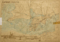
 Plan historique de Lorient édité par "le Nouvelliste du Morbihan" - btv1b8458695g.jpg 7,714 × 9,847; 10.5 MB
-
 Plan Rade Lorient XVIIe siècle.jpg 1,355 × 899; 611 KB
-
 Trescat Lorient 1903-1703.gif 676 × 475; 225 KB


