Category:Old maps of Lohtaja
Jump to navigation
Jump to search
Media in category "Old maps of Lohtaja"
The following 9 files are in this category, out of 9 total.
-
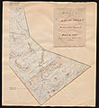
 Parish map of Kannus, Lohtaja in Finland, square 2324 08.jpg 6,770 × 6,920; 2.94 MB
-
 Parish map of Kannus, Lohtaja in Finland, square 2324 09.jpg 7,112 × 6,918; 3.36 MB
-
 Parish map of Kannus, Lohtaja in Finland, square 2324 11.jpg 6,776 × 6,834; 5.64 MB
-
 Parish map of Kannus, Lohtaja in Finland, square 2324 12.jpg 6,782 × 7,060; 5.73 MB
-
 Parish map of Kannus, Lohtaja in Finland, square 2342 02, 2342 01.jpg 6,946 × 6,901; 4.21 MB
-
 Parish map of Kannus, Lohtaja in Finland, square 2342 03, 2342 06.jpg 7,426 × 6,805; 4.67 MB
-
 Parish map of Kannus, Lohtaja in Finland, square 2342 05, 2342 04.jpg 7,032 × 7,680; 4.76 MB
-
 Parish map of Kannus, Lohtaja in Finland, square 2413 10.jpg 6,729 × 6,807; 3.06 MB
-
 Parish map of Kannus, Lohtaja in Finland, square 2431 01.jpg 6,693 × 6,824; 3.26 MB


