Category:Old maps of Lindisfarne
Jump to navigation
Jump to search
Media in category "Old maps of Lindisfarne"
The following 25 files are in this category, out of 25 total.
-
 17th Century maps of Holy Island, Guernsey, Farne Island, and Jersey.JPG 3,456 × 2,592; 5.68 MB
-
 Holy Iland - btv1b53056270g (1 of 2).jpg 3,296 × 2,728; 1.17 MB
-
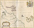
 "Insula Sacra, vulgo Holy Iland, et Farne" (22233549946).jpg 3,741 × 3,098; 1.64 MB
-
 Insula Sacra et Farne by Blaeu.jpg 8,814 × 6,705; 15.12 MB
-
-
 Holy iland ; Garnsey ; Farne ; Iarsey - CBT 6599427.jpg 5,761 × 4,646; 6.31 MB
-
 Northumberland Map Sheet IIX (including Elwick, Holy Island, Kyloe, Ross).jpg 8,176 × 5,680; 17.07 MB
-
 Northumberland Map Sheets VIII + IIX stitched (including Elwick, Holy Island, Kyloe, Ross).jpg 8,176 × 7,200; 27.35 MB
-

-

-
 Earlier Holy Island Waggonway to a jetty on the SW of the island.png 778 × 1,242; 973 KB
-

-
 Farne - btv1b53056802r (1 of 2).jpg 3,296 × 2,640; 1.17 MB
-
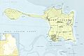 Holy Island (Overview).jpg 4,512 × 3,024; 7.21 MB
-
 Holy Island (stitched).jpg 292 × 534; 62 KB
-
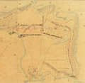
 Holy Island eastern waggonway.png 679 × 650; 602 KB
-
 Holy Island Waggonway (stitched).jpg 1,412 × 3,166; 583 KB
-
 Holy Island Waggonway - John Higgins’ map of 1860.png 908 × 887; 1.63 MB
-
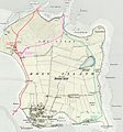 Holy Island waggonways.jpg 1,968 × 2,112; 2.37 MB
-
 Holy Island western waggonway.jpg 1,136 × 2,112; 1.46 MB
-
 Holy Island, Staples and Barwick - btv1b53010339x.jpg 7,924 × 6,802; 8.35 MB
-
 North end of earlier Holy Island Waggonway to a jetty on the SW of the island.png 1,439 × 616; 1,015 KB
-
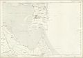
 Ordnance Survey One-Inch Sheet 64 Berwick-upon-Tweed, Published 1947.jpg 10,971 × 12,777; 24.02 MB
-
 Ordnance Survey One-Inch Sheet 64 Berwick-upon-Tweed, Published 1965.jpg 8,598 × 10,667; 14.95 MB
-
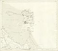
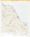
 Ordnance Survey Sheet NU 04 Lindisfarne, Published 1954.jpg 11,392 × 9,267; 29.1 MB

.jpg)
.jpg)

.5.(57).jpg)

.jpg)
.jpg)
.jpg)


.jpg)
.jpg)
.jpg)

.jpg)


_Edited_by_E._G._Ravenstein_..._Illustrated,_etc%27_(11188116906).jpg)