Category:Old maps of Leros
Jump to navigation
Jump to search
Media in category "Old maps of Leros"
The following 21 files are in this category, out of 21 total.
-
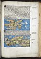
 Buendelmonti Arcipelagi 27v.jpg 2,113 × 1,399; 538 KB
-
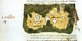 I Hero - Buondelmonti Cristoforo - 1420.jpg 945 × 484; 176 KB
-
 Kalimnos and Leros RMG F1581.tiff 4,971 × 6,784; 96.48 MB
-
 Liber insularum Arcipelagi (Cotton MS Vespasian a.XIII.art.1, f.27v).jpeg 5,076 × 6,561; 37.06 MB
-
 Liber Insularum Cycladum (Arundel MS 93.art.7, f.147r).jpeg 5,502 × 7,892; 51.77 MB
-
 Piri Reis - Map of the Island of Leros - Walters W65886A - Full Page.jpg 1,208 × 1,800; 2.62 MB
-
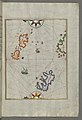
 (Lero) - Sonetti Bartolommeo Dalli - 1485.jpg 1,313 × 1,500; 373 KB
-

-
 "Insula de Lero" (22765292053).jpg 3,318 × 4,578; 1.01 MB
-
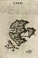
 Map of Leros - Bordone Benedetto - 1547.jpg 800 × 464; 161 KB
-
 Lero - Boschini Marco - 1658.jpg 529 × 800; 169 KB
-
 Lero boschini.jpg 1,013 × 1,566; 350 KB
-
 Leria - Piacenza Francesco - 1688.jpg 1,020 × 1,500; 554 KB
-
 Lero - Dapper Olfert - 1688.jpg 800 × 646; 223 KB
-

-
 Admiralty Chart No 3926 Lero Island and Approaches, Published 1944.jpg 12,293 × 8,443; 16.78 MB
-
 Fortezza di Lero - Coronelli Vincenzo Maria (padri) & Parissoti Antonio - 1688.jpg 1,500 × 1,208; 710 KB
-
 Lero - Marco Boschini - btv1b530117729 (1 of 2).jpg 1,706 × 2,588; 580 KB
-
 Lero - par d'Anville ; d'après Thevet - btv1b530117763.jpg 2,741 × 2,348; 597 KB
-

-


.jpeg)
.jpeg)

_-_Sonetti_Bartolommeo_Dalli_-_1485.jpg)
.jpg)
.jpg)


_%26_Parissoti_Antonio_-_1688.jpg)
.jpg)


