Category:Old maps of Lannion
Jump to navigation
Jump to search
Media in category "Old maps of Lannion"
The following 5 files are in this category, out of 5 total.
-
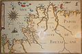 033 Carte de la partie ouest des Côtes-d'Armor datant de 1640.JPG 2,231 × 1,495; 905 KB
-
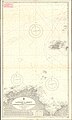 Admiralty Chart No 2668 Lannion to Erquy, Published 1968.jpg 11,287 × 18,802; 44.59 MB
-

-

-
 Servel - Cadaste C, 2ème feuille - 1826.jpg 2,169 × 1,823; 629 KB


.jpg)

