Category:Old maps of Landstraße (Vienna)
Jump to navigation
Jump to search
Media in category "Old maps of Landstraße (Vienna)"
The following 11 files are in this category, out of 11 total.
-
 Histor Museum Wien- u Vorstadtpläne 1835 - 3.jpg 4,032 × 3,024; 4.08 MB
-
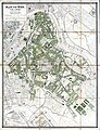 Katasterplan Bezirk Landstraße (Plan von Wien) 1885.jpg 6,546 × 8,527; 77.82 MB
-
 Palais Rasumofsky (Vasquez).jpg 2,816 × 2,112; 3.77 MB
-
 Wien 1820 Vasquez Landstrasse.jpg 1,379 × 1,005; 879 KB
-
 Wien 1830 Vasquez Landstrasse (Modena palais).png 960 × 613; 1.04 MB
-
 Wien 1830 Vasquez Landstrasse crop.jpg 1,970 × 1,468; 1.28 MB
-
 Wien 1830 Vasquez Landstrasse Erdberg.jpg 1,975 × 1,464; 1.23 MB
-
 Wien 1830 Vasquez Landstrasse Landstrasse.jpg 1,975 × 1,464; 1.46 MB
-
 Wien 1830 Vasquez Landstrasse Weissgerber.jpg 1,975 × 1,464; 1.2 MB
-
 Wien Stadtplan 1824.pdf 2,479 × 1,752, 9 pages; 11.12 MB
-
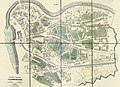
 Wien-landstrasse.jpg 1,492 × 1,098; 764 KB

_1885.jpg)
.jpg)

.png)


