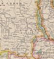
Category:Old maps of Lake Tanganyika
Jump to navigation
Jump to search
Media in category "Old maps of Lake Tanganyika"
The following 10 files are in this category, out of 10 total.
-
Karte von Inner-Afrika, Blatt 10 - Unyamwesi.png 9,033 × 7,428; 94.16 MB
-
Lieut. V.L. Cameron's Aufnahme des südlichen Theiles des Tancanjika See's, 1874.png 1,702 × 4,367; 6.53 MB
-
190 of 'Tanganyika ... Second edition' (11219786416).jpg 1,168 × 2,213; 414 KB
-
Africa 1909, Edward Hertslet (Urua, detail2).jpg 548 × 596; 80 KB
-
248 of 'Tanganyika ... Second edition' (11215521076).jpg 2,176 × 1,367; 488 KB


