Category:Old maps of Lake Geneva
Jump to navigation
Jump to search
Subcategories
This category has only the following subcategory.
M
Media in category "Old maps of Lake Geneva"
The following 34 files are in this category, out of 34 total.
-
 Print, book-illustration, map (BM 1982,U.2436).jpg 1,895 × 1,757; 995 KB
-
 UBBasel Map 1580-1589 Kartenslg AA 127 Lago di Geneva.tiff 9,594 × 6,196, 2 pages; 170.1 MB
-
 Map of Lake Geneva (1600) closer view.jpg 800 × 600; 148 KB
-
 Map of Lake Geneva (1600).jpg 800 × 1,067; 167 KB
-
 UBBasel Map 1628 Kartenslg Schw B 120.tif 4,544 × 3,450, 2 pages; 44.88 MB
-

-

-

-

-
-
 UBBasel Map Genfer See 1640-1660 Kartenslg Schw B 153.tif 11,683 × 9,154, 2 pages; 306 MB
-
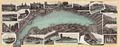
 Veüe du pays autour de Genève.jpg 4,594 × 2,626; 6.14 MB
-
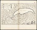
 Carte du Lac de Genève et des Pays Circonvoisins 1730.jpg 5,251 × 3,761; 11.09 MB
-

-
 UniversitaetBern-SammlungRyhiner GegendUmGenf1770-1780-31x44cm Ryh 3225 16.jpg 1,024 × 726; 258 KB
-

-
 Ferney - btv1b105676676.jpg 10,218 × 7,120; 9.27 MB
-
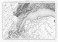 Swisstopo Dufourkarte BLATT XVI GENEVE LAUSANNE LT TK 016 1845.tiff 11,983 × 8,600; 98.3 MB
-

-

-
 CH-NB-Panorama du lac Léman et de ses environs-19415-page003.tif 6,392 × 2,480; 42.04 MB
-

-

-

-

-
 Gèneve - Lac Léman.jpg 3,337 × 2,123; 565 KB
-
 FMIB 36876 Seiches Longitudinales et Transversales du Lac Leman.jpeg 1,067 × 775; 366 KB
-

-
 France-Switzerland border 3.jpg 1,398 × 928; 194 KB
-
 CH-NB Photoglob-Wehrli EAD-WEHR-14104-B.tif 5,684 × 7,494, 2 pages; 81.31 MB
-
 Extrait Tablede Peutinger Secteur Rhône et Alpes.jpg 896 × 356; 196 KB
-
 UBBasel Map Genfer See 1607-1620 Kartenslg Schw B 151.tif 12,919 × 8,794, 2 pages; 325.06 MB
-
 UBBasel Map Genfer See 1640-1660 Kartenslg Schw B 152.tif 10,132 × 7,360, 2 pages; 426.76 MB
-
 UBBasel Map Genfer See 1640-1660 Kartenslg Schw B 152a.tif 11,479 × 8,708, 2 pages; 571.42 MB
.jpg)
_closer_view.jpg)
.jpg)
.jpg)
.jpg)
.jpg)

.jpg)


.jpg)

.jpg)

%27_(11039583075).jpg)
%27_(11245005603).jpg)
.jpg)
.jpg)
.jpg)
.jpg)

_Victor_Attinger_(14780878042).jpg)
