Category:Old maps of Kos
Jump to navigation
Jump to search
Media in category "Old maps of Kos"
The following 34 files are in this category, out of 34 total.
-
 Choa nunc Lango - Buondelmonti Cristoforo - 1420.jpg 789 × 980; 285 KB
-
 Kos and Bodrum RMG F1580.tiff 4,984 × 6,776; 96.62 MB
-
 Liber insularum Arcipelagi (Cotton MS Vespasian a.XIII.art.1, f.26v).jpeg 5,120 × 6,561; 43.95 MB
-
 Liber Insularum Cycladum (Arundel MS 93.art.7, f.146v).jpeg 5,775 × 8,285; 61.14 MB
-

-
 (Lango) - Sonetti Bartolommeo Dalli - 1485.jpg 1,244 × 1,500; 389 KB
-

-
 "Lango" (23366316326).jpg 3,353 × 4,623; 1.25 MB
-
 Buondelmonti Bodleian Cos.png 685 × 1,119; 2.18 MB
-
 Map of Kos - Bordone Benedetto - 1547.jpg 800 × 494; 157 KB
-
 Lango RMG F1708.tiff 4,799 × 7,291; 100.11 MB
-
 Lango - Rosaccio Giuseppe - 1598.jpg 1,500 × 873; 664 KB
-
 Lango - Gioseppe Rosaccio - btv1b53011452b.jpg 2,280 × 1,462; 590 KB
-
 Lango - Beauvau Henri De - 1615.jpg 800 × 560; 224 KB
-
 Lango - Boschini Marco - 1658.jpg 525 × 800; 186 KB
-
 Lango - Marco Boschini - btv1b53011592c (1 of 2).jpg 1,669 × 2,460; 613 KB
-
 Eylant Stanko of Lango - Dapper Olfert - 1688.jpg 800 × 709; 265 KB
-
 Isola di Stanchio, o Lango - (par le Père Coronelli) - btv1b53011649t.jpg 3,176 × 2,768; 2.1 MB
-

-
 Lango - Piacenza Francesco - 1688.jpg 1,013 × 1,500; 821 KB
-
 Cos insula hode Lango - Peeters Jacob - 1690.jpg 1,500 × 1,044; 848 KB
-
 Kos Mediev Map.jpg 900 × 697; 731 KB
-
 KosMediev.jpg 900 × 723; 152 KB
-
 Co - (par d'Anville) ; (d'après Thevet) - btv1b530116540.jpg 2,936 × 2,490; 677 KB
-

-
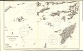
 Admiralty Chart No 1604 The Gulfs of Kos (Gökova), Doris, & Symi, Published 1844.jpg 12,234 × 8,180; 11.44 MB
-
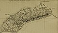
 Admiralty Chart No 1898 Kos Niseros and Piskopi (Tilos), Published 1848.jpg 6,159 × 8,301; 3.95 MB
-
 Admiralty Chart No 872 Kalimno to Rhodes, Published 1896.jpg 18,357 × 11,281; 22.07 MB
-
 Archives des missions scientifiques et littéraires (1876) (19131939293).jpg 3,024 × 1,774; 944 KB
-
 Archives des missions scientifiques et littéraires (1876) (19131941943).jpg 2,608 × 1,484; 834 KB
-

-

-

-


.jpeg)
.jpeg)
.jpg)
_-_Sonetti_Bartolommeo_Dalli_-_1485.jpg)
.jpg)
.jpg)


.jpg)

_-_btv1b53011649t.jpg)
_%26_Parissoti_Antonio_-_1688.jpg)


_;_(d%27apr%C3%A8s_Thevet)_-_btv1b530116540.jpg)
%27_(11003982763).jpg)
,_Doris,_%26_Symi,_Published_1844.jpg)
,_Published_1848.jpg)

_(19131939293).jpg)
_(19131941943).jpg)


