Category:Old maps of Kalmar County
Jump to navigation
Jump to search
Subcategories
This category has the following 2 subcategories, out of 2 total.
O
- Old maps of Kalmar (9 F)
V
- Old maps of Västervik (3 F)
Media in category "Old maps of Kalmar County"
The following 14 files are in this category, out of 14 total.
-

-
 Admiralty Chart No 2361 Oland to Landsort, Published 1905.jpg 10,730 × 16,026; 63.69 MB
-
 Charta öfwer Calmare län och Öland 1795.tif 14,862 × 23,661; 1,017.86 MB
-
 Geographisk charta öfwer Calmare län och Öland 1711.tif 14,224 × 27,151; 1.08 GB
-
 Kungsboken-karta-kalmarsund.jpg 10,109 × 9,893; 6.86 MB
-
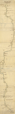 Landskapskarta Emån.png 1,394 × 10,519; 12.09 MB
-
 Landskapskarta Öland.png 2,345 × 1,406; 2.92 MB
-
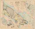
 Landskapskarta Öland2.png 10,227 × 1,845; 17.4 MB
-
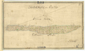
 Ljunggren Oscarshamn.png 1,605 × 2,105; 2.25 MB
-
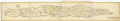
 Ljunggren Westerwik.png 2,805 × 2,305; 8.6 MB
-
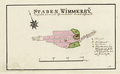
 Ljunggren Wimmerby.png 2,105 × 2,705; 7.17 MB
-

-
 Wiblingen Kalmar.png 2,505 × 1,966; 5.78 MB
-
 Wiblingen Vimmerby.png 2,373 × 1,461; 3.21 MB
.jpg)


