Category:Old maps of Joutseno
Jump to navigation
Jump to search
Media in category "Old maps of Joutseno"
The following 12 files are in this category, out of 12 total.
-
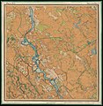
 Parish map of Joutseno in Finland, square 3133 12.jpg 7,233 × 7,256; 3.11 MB
-
 Parish map of Joutseno in Finland, square 3134 10.jpg 7,356 × 7,327; 3.98 MB
-
 Parish map of Joutseno in Finland, square 3134 11.jpg 7,304 × 7,248; 3.7 MB
-
 Parish map of Joutseno in Finland, square 4111 03.jpg 7,352 × 7,311; 3.87 MB
-
 Parish map of Joutseno in Finland, square 4112 01.jpg 7,365 × 7,221; 4.73 MB
-
 Parish map of Joutseno in Finland, square 4112 02.jpg 7,365 × 7,221; 4.39 MB
-
 Parish map of Joutseno in Finland, square 4112 03, 3134 12.jpg 8,676 × 7,208; 6.44 MB
-
 Parish map of Joutseno in Finland, square 4112 04.jpg 7,300 × 7,285; 3.62 MB
-
 Parish map of Joutseno in Finland, square 4112 05.jpg 7,301 × 7,233; 3.85 MB
-

-
 Senate Atlas, 1870–1907. Sheet XV 48 Joutseno.jpg 6,936 × 7,121; 7.68 MB
-
 Senate Atlas, 1870–1907. Sheet XVI 49 Jääski.jpg 6,893 × 7,083; 7.23 MB


_(14742185266).jpg)

