Category:Old maps of Jargeau
Jump to navigation
Jump to search
Media in category "Old maps of Jargeau"
The following 18 files are in this category, out of 18 total.
-
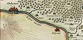
 1634 Gergeau dans le Duché d'Orléans.jpg 797 × 388; 260 KB
-
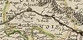
 1642 Gergeau Carte Gâtinais.jpg 798 × 390; 259 KB
-
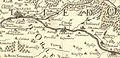
 1650 Gouvernement d'Orléans Carte Gergeau.jpg 798 × 392; 244 KB
-
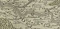
 1653 Diocèse d'Orléans Carte Gergeau.jpg 799 × 392; 221 KB
-
 1690 Généralité d'Orléans Carte Jargeau.jpg 800 × 389; 295 KB
-
 1692 Governo Generale Orléanais Gergeau.jpg 800 × 391; 282 KB
-
 1716 Canaux Cartes Jargeau.jpg 792 × 385; 245 KB
-
 1744 Carte de Cassini Jargeau.jpg 693 × 364; 210 KB
-
 1780 Généralité d'Orléans Carte Gergeau.jpg 799 × 388; 186 KB
-
 1826 Loiret Carte Jargeau.jpg 800 × 391; 264 KB
-
 1837 Loiret Carte Jargeau.jpg 800 × 391; 225 KB
-
 1838 Loiret Carte Jargeau.jpg 800 × 391; 236 KB
-
 1850 Loiret Carte Jargeau.jpg 800 × 390; 243 KB
-
 1873 Loiret Carte Jargeau.jpg 800 × 391; 249 KB
-
 1873 Sologne Carte Jargeau.jpg 800 × 394; 234 KB
-
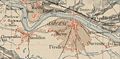
 1886 Carte d'état-major Jargeau.jpg 800 × 392; 284 KB
-
 1895 Loiret Carte Jargeau.jpg 799 × 390; 279 KB
-
 18è siècle Darvoy Jargeau Dessin Carte.jpg 800 × 389; 232 KB


