Category:Old maps of Ingolstadt
Jump to navigation
Jump to search
Urban districts (cities): Augsburg · Bamberg · Erlangen · Fürth · Ingolstadt · Kempten · Munich · Nuremberg · Passau · Regensburg · Schweinfurt · Straubing · Würzburg
Use the appropriate category for maps showing all or a large part of Ingolstadt. See subcategories for smaller areas:
| If the map shows | Category to use |
|---|---|
| Ingolstadt on a recently created map | Category:Maps of Ingolstadt or its subcategories |
| Ingolstadt on a map created more than 70 years ago | Category:Old maps of Ingolstadt or its subcategories |
| the history of Ingolstadt on a recently created map | Category:Maps of the history of Ingolstadt or its subcategories |
| the history of Ingolstadt on a map created more than 70 years ago | Category:Old maps of the history of Ingolstadt or its subcategories |
Subcategories
This category has the following 2 subcategories, out of 2 total.
I
- Ingolstadt - btv1b532385724 (2 F)
Media in category "Old maps of Ingolstadt"
The following 8 files are in this category, out of 8 total.
-

-
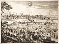 Dankaerts-Historis-9338.tif 4,878 × 3,618; 50.53 MB
-
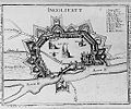 Festung Ingolstadt 1500.jpg 300 × 251; 32 KB
-
 Festung Ingolstadt 1800.jpg 322 × 250; 30 KB
-
 Heutiges Stadtgebiet Ingolstadt 1903 - Festungsanlagen.pdf 8,041 × 8,137; 110.97 MB
-
 Historischer Stadtplan v Stadt Ingolstadt 1816.jpg 4,398 × 4,073; 6.99 MB
-
 Stadt Ingolstadt 1816 i2-1-2.jpg 2,500 × 2,624; 1,009 KB
-
 Stadt Ingolstadt 1816 i2.jpg 2,500 × 2,499; 964 KB
_Mattes_2022-02-26.jpg)


