Category:Old maps of Huningue
Jump to navigation
Jump to search
Media in category "Old maps of Huningue"
The following 23 files are in this category, out of 23 total.
-
 UBBasel Map Basel Basel Hüningen 1737 VB A2-2-8.tif 5,764 × 5,399, 2 pages; 89.06 MB
-

-
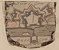
 Belagerung Brueckenkopf Festung Hueningen 1796-1797 Ausschnitt.jpg 1,873 × 1,328; 852 KB
-
 Belagerung Brueckenkopf Festung Hueningen 1796-1797.jpg 4,421 × 2,773; 4.3 MB
-
 Fortification of Huningue.jpg 1,988 × 2,954; 4.07 MB
-
 Huningen - btv1b102230879.jpg 2,663 × 2,420; 1.03 MB
-
 Huningen - btv1b10223250p.jpg 4,560 × 3,590; 2.95 MB
-

-
 Huningen hart an Basel gelegen - btv1b10223468f.jpg 7,885 × 6,123; 3.94 MB
-
 Huningue - btv1b8492675z.jpg 7,507 × 5,646; 4.49 MB
-
 Huningue - btv1b8492676c.jpg 6,927 × 4,590; 3.5 MB
-
 Huningue - btv1b8592065r.jpg 3,296 × 2,793; 1.78 MB
-

-
-

-
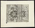
 Huningue-Fortifications-17e siècle.jpg 1,806 × 2,807; 2.35 MB
-
 Hunningen - btv1b10223093x.jpg 3,510 × 2,778; 1.59 MB
-

-
 UBBasel Map 1681 VB A2-2-4 Fortification Hueningen.tiff 6,204 × 8,491, 2 pages; 150.74 MB
-
 UBBasel Map 1797 VB A2-2-15.tif 7,545 × 6,128, 2 pages; 132.3 MB
-
 UBBasel Map 1797 VB A2-2-16 Huningue.tiff 5,133 × 4,047, 2 pages; 59.46 MB
-
 Карта к статье «Гюнинген». Военная энциклопедия Сытина (Санкт-Петербург, 1911-1915).jpg 1,055 × 1,308; 251 KB
-

_-_dessin%C3%A9s_par..._-_btv1b52503974g_(073_of_106).jpg)


_;_H._van_Loon_sculp_-_btv1b8440896t.jpg)


.jpg)
.jpg)