Category:Old maps of Hoorn, North Holland
Jump to navigation
Jump to search
Media in category "Old maps of Hoorn, North Holland"
The following 18 files are in this category, out of 18 total.
-

-
 Hoorn - Blaeu 1649.jpg 5,500 × 4,421; 3.87 MB
-
 Hoorn, Oosterpoorten (Blaeu 1649).jpg 1,152 × 864; 403 KB
-
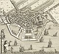
 Atlas de Wit 1698-pl026-Hoorn-KB PPN 145205088.jpg 2,000 × 1,662; 2.02 MB
-
-
 Hoorn, Gemeenteatlas van Nederland.jpg 1,476 × 1,112; 439 KB
-
 Hoorn - stad, Gemeenteatlas van Nederland.jpg 1,455 × 1,114; 625 KB
-

-
 Atlante Neroni - Horn.jpg 2,242 × 1,495; 650 KB
-
 Hoorn (1648).jpg 4,698 × 4,288; 2.6 MB
-
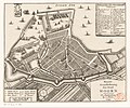
 Kaart en voornaamste gebouwen van Hoorn, RP-P-AO-OB-24.744.jpg 7,830 × 4,516; 6.26 MB
-
 Kaart van Hoorn door Johannes Blaeu uit 1649.jpg 3,220 × 2,552; 2.64 MB
-
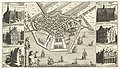
 Kaart van Hoorn door Velius uit 1615.jpg 3,076 × 2,328; 2.12 MB
-

-
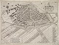
 Nieuwe grondtekening der stad Hoorn - btv1b53043240w.jpg 3,083 × 2,627; 1.58 MB
-
 Plattegrond van Hoorn - Hoorn - 20115535 - RCE.jpg 1,200 × 884; 393 KB
-

-
 Plattegrond Vogelvlucht, door P. ten Wael - Hoorn - 20115538 - RCE.jpg 1,200 × 866; 295 KB


.jpg)

,_RP-P-AO-7-38.jpg)


.jpg)

.jpg)


.jpg)


,_RP-P-AO-7-36-3.jpg)
