Category:Old maps of Hiiumaa
Jump to navigation
Jump to search
Media in category "Old maps of Hiiumaa"
The following 4 files are in this category, out of 4 total.
-
 Russian Empire 1745 (Map III in Latin).jpg 7,704 × 6,754; 17.16 MB
-
 Admiralty Chart No 2241 Gulf of Finland, Published 1862.jpg 8,386 × 12,279; 11.81 MB
-
 Admiralty Chart No 870 Wormso Sound, Published 1881, New Edition 1921.jpg 8,172 × 11,085; 11.36 MB
-
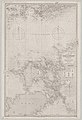
 Bm04112abm.jpg 509 × 640; 79 KB
.jpg)


