Category:Old maps of Hesdin
Jump to navigation
Jump to search
Subcategories
This category has the following 3 subcategories, out of 3 total.
M
Media in category "Old maps of Hesdin"
The following 18 files are in this category, out of 18 total.
-
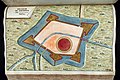 Atlante Neroni - Hesdim.jpg 2,242 × 1,495; 618 KB
-
 Plan d'Hesdin 1661 (centered).svg 3,360 × 3,370; 9.03 MB
-
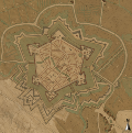
 Plan d'Hesdin 1661.jpg 7,520 × 6,080; 6.68 MB
-
 Plan d'Hesdin 1661.svg 9,540 × 9,380; 9.03 MB
-
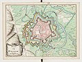
 Plan d'Hesdin 1688.jpg 8,578 × 5,893; 6.37 MB
-
 Plan d'Hesdin 1693 (centered).svg 2,100 × 2,250; 4.47 MB
-
 Plan d'Hesdin 1693.jpg 6,374 × 5,035; 3.31 MB
-
 Plan d'Hesdin 1693.svg 6,850 × 6,400; 4.47 MB
-
 Plan d'Hesdin 16xx.jpg 6,440 × 4,680; 4.13 MB
-
 Plan d'Hesdin.jpg 2,742 × 2,081; 1,007 KB
-
 Plan d'Hesdin (Vauban, 1707).jpg 8,321 × 6,141; 6.69 MB
-
 Plan d'Hesdin 1822.jpg 4,920 × 7,377; 6.69 MB
-
 371 of 'Histoire d'Hesdin' (11234373443).jpg 1,283 × 2,191; 593 KB
-
 Atlas de Wit 1698-pl087-Hesdin-KB PPN 145205088.jpg 2,000 × 1,653; 1.31 MB
-

-
 Carte Mouriez Cassin.jpg 3,563 × 2,821; 5 MB
-
 Manesson-Travaux-de-Mars 9663.tif 3,440 × 5,264; 51.84 MB
-
 Siege of Hesdin in 1639 (Atlas van Loon).jpg 5,500 × 4,472; 3.27 MB

.svg)


.svg)


.jpg)

.jpg)

.jpeg)

.jpg)