Category:Old maps of Harlingen
Jump to navigation
Jump to search
Subcategories
This category has only the following subcategory.
Media in category "Old maps of Harlingen"
The following 13 files are in this category, out of 13 total.
-
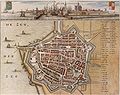
 Harlingen 1649 Blaeu.jpg 1,590 × 1,317; 467 KB
-
 Plattegrond blauw, bibliotheek Monumenten Zorg - Harlingen - 20101594 - RCE.jpg 1,200 × 935; 377 KB
-
 1664 harlingen.JPG 1,663 × 1,311; 587 KB
-
 Oude kaart van Harlingen.jpg 3,373 × 2,668; 5.61 MB
-
 Atlas de Wit 1698-pl054-Harlingen-KB PPN 145205088.jpg 2,000 × 1,659; 1.79 MB
-
 Almenum Kerk 1664.jpg 148 × 180; 17 KB
-
 AlmenumKerk1649.jpg 132 × 180; 11 KB
-
 Harlinga - btv1b532255341 (1 of 2).jpg 3,421 × 3,022; 3.13 MB
-
 Harlingen - 20101593 zoom.jpg 1,553 × 894; 487 KB
-
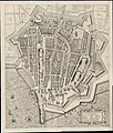 Harlingen 1610.jpg 3,950 × 4,645; 4.44 MB
-

-
 Plattegrond modern, in bezit Monumenten Zorg - Harlingen - 20101595 - RCE.jpg 1,200 × 939; 290 KB
-
 Plattegrond van Deventer - Harlingen - 20101596 - RCE.jpg 885 × 1,200; 206 KB


.jpg)


