Category:Old maps of Hainan
Jump to navigation
Jump to search
Subcategories
This category has only the following subcategory.
Media in category "Old maps of Hainan"
The following 82 files are in this category, out of 82 total.
-
 Da Ming yu di tu LOC 2002626776-15.jpg 9,580 × 9,042; 13.84 MB
-
 Da Ming yu di tu LOC 2002626776-15.tif 9,580 × 9,042; 247.83 MB
-
 Guang Yutu 1558 Vol 1 Pg 47 Guangdong 1.jpg 4,380 × 4,658; 4.04 MB
-
 Fen ye yu tu. LOC 2002626777-16.jpg 4,272 × 5,080; 1.9 MB
-
 Fen ye yu tu. LOC 2002626777-16.tif 4,272 × 5,080; 62.09 MB
-
 Carte manuscrite des côtes de Tonquin et de l'île d'Ainam - Jaillot fecit - btv1b5963006q.jpg 10,096 × 6,904; 8.24 MB
-
 Atlas maior 1655 - vol 10 - Novus Atlas Sinensis - China - P1080382.JPG 2,560 × 1,920; 3.28 MB
-
 Imperii Sinarum nova descriptio - btv1b53179352v (1 of 2).jpg 9,820 × 7,274; 8.36 MB
-
 Novvs atlas Sinensis. LOC 2002625249-1.jpg 7,768 × 6,126; 5.72 MB
-
 Novvs atlas Sinensis. LOC 2002625249-1.tif 7,768 × 6,126; 136.15 MB
-

-
 "Quantung, Imperii Sinarum provincia duodecima" (22240445622).jpg 3,598 × 3,006; 2.12 MB
-
 AMH-6745-NA Map of the Chinese coast near Tonquin.jpg 2,400 × 1,669; 745 KB
-

-
 Qvantvng - Atlas Maior, vol 11, map 24 - Joan Blaeu, 1667 - BL 114.h(star).11.(24).jpg 4,000 × 3,351; 1.93 MB
-
 Anam 1668 Joan Blaeu 05007.jpg 4,912 × 3,264; 4.6 MB
-
 Atlas Van der Hagen-KW1049B13 033-IMPERII SINARVM NOVA DESCRIPTO.jpeg 5,500 × 4,292; 3.52 MB
-
 Atlas Van der Hagen-KW1049B13 048-QVANTVNG, IMPERII SINARVM PROVINCIA DVODECIMA.jpeg 5,500 × 4,620; 3.12 MB
-

-

-
 Der Jesuiten-Atlas der Kanghsi-Zeit - China und die Aussenlaender LOC 74650033-31.jpg 9,669 × 8,228; 8.69 MB
-
 Der Jesuiten-Atlas der Kanghsi-Zeit - China und die Aussenlaender LOC 74650033-31.tif 9,669 × 8,228; 227.61 MB
-
 Kouang-Toung - par Jean-Baptiste d'Anville - btv1b53009299t.jpg 6,495 × 5,141; 5.62 MB
-
 AMH-8156-KB Map of Tonquin.jpg 1,712 × 2,400; 849 KB
-

-
 Province de Quang-Tong - (tirée du P. Duhalde) - btv1b85951154.jpg 10,496 × 7,978; 12.95 MB
-

-
-
 Province du Quang-tong (French map of Guangdong Province, China, 1735).jpg 5,700 × 4,308; 3.41 MB
-
 AnNamGiang1735-1740-1839.jpg 2,280 × 1,080; 1.12 MB
-
 Anville Nouvel atlas de la Chine - Page46 quang tong.jpg 4,600 × 3,720; 5.83 MB
-

-
 South Asia, 1744.jpg 6,453 × 5,161; 7.02 MB
-
 Da Qing fen sheng yu tu LOC 2002626726-16.jpg 5,296 × 4,515; 2.26 MB
-
 Da Qing fen sheng yu tu LOC 2002626726-16.tif 5,296 × 4,515; 68.41 MB
-

-

-

-
 Zhi li ge sheng yu di quan tu - Zhang Zongjing - btv1b53103898v (33 of 69).jpg 5,137 × 4,427; 2.83 MB
-

-

-
 Haï - Nan. L'Empire Chinois et du Japon (1833) (cropped).jpg 638 × 384; 100 KB
-
 Guangdong quan tu LOC gm71005120.jpg 13,026 × 10,962; 17.63 MB
-
 Hunan Guangdong he tu. LOC gm71005129.jpg 9,297 × 9,186; 8.78 MB
-
 Hunan Guangdong he tu. LOC gm71005129.tif 9,297 × 9,186; 244.34 MB
-
 Dian Yue Yuenan lian jie yu tu. LOC gm71005069.jpg 5,137 × 7,267; 4.78 MB
-
 Dian Yue Yuenan lian jie yu tu. LOC gm71005069.tif 5,137 × 7,267; 106.8 MB
-
 Nan bei yang he tu. LOC gm71005215.jpg 5,106 × 7,122; 4.64 MB
-
 Nan bei yang he tu. LOC gm71005215.tif 5,106 × 7,122; 104.04 MB
-
 Nan yang fen tu. LOC gm71005139.jpg 5,100 × 7,186; 5.22 MB
-
 Nan yang fen tu. LOC gm71005139.tif 5,100 × 7,186; 104.85 MB
-
 Huang chao zhi sheng di yu quan tu - btv1b531099218 (21 of 38).jpg 6,177 × 4,548; 3.81 MB
-

-
 Guangdong quan sheng shui lu yu tu LOC gm71005159.jpg 14,152 × 11,530; 22.07 MB
-
 Guangdong quan sheng shui lu yu tu LOC gm71005159.tif 14,152 × 11,530; 466.84 MB
-
 Tian xia zong yu tu. LOC 2002626780-17.jpg 3,865 × 3,150; 1.15 MB
-
 Tian xia zong yu tu. LOC 2002626780-17.tif 3,865 × 3,150; 34.83 MB
-
 Mission D'Exploration Commerciale en Chine 1895-97 -- Carte du Kouang-Si et Kouang Toung.jpg 8,857 × 5,409; 6.94 MB
-
 1956 map of Hainan Island, People's Republic of China (cropped).jpg 3,663 × 3,510; 2.43 MB
-
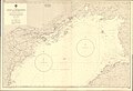 Admiralty Chart No 3990 Gulf of Tongking (Northern Sheet), Published 1961.jpg 16,203 × 11,097; 59.1 MB
-
 Txu-oclc-10552568-ne49-1.jpg 5,000 × 3,811; 4 MB
-
 Admiralty Chart No 1018 South Coast of Hainan, Published 1786.jpg 6,412 × 4,146; 5.06 MB
-
 Admiralty Chart No 1019 Yu-lin-kan Bay on the South Coast of Hainan, Published 1774.jpg 3,872 × 3,158; 2.27 MB
-
 Admiralty Chart No 2660 China Sea Sheet III (North West) Cam Ranh Bay to Hong Kong, Published 1859.jpg 15,585 × 23,512; 75.64 MB
-
 AMH-5649-KB Map depicting the journey by Joan Nieuhoff from Canton to Peking.jpg 2,400 × 2,024; 682 KB
-
-
 EB9 China.png 2,754 × 3,531; 14.21 MB
-
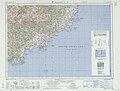
 Hainan 1820-1875.jpg 11,719 × 23,437; 36.26 MB
-
 Huang chao zhi sheng yu di quan tu - Lu ying sheng - btv1b52505943g.jpg 16,210 × 9,584; 23.59 MB
-
 Imperii Sinarum nova descriptio - btv1b5963029q.jpg 7,232 × 5,592; 6.17 MB
-
 Imperii Sinarum nova descriptio - btv1b84415340.jpg 10,618 × 7,800; 10.3 MB
-

-
 Navigantium atque itinerantium bibliotheca Fleuron N010532-44.png 2,935 × 517; 55 KB
-
 Paradigma XV Provinciarum &c.png 2,543 × 2,700; 14.45 MB
-
 Quantung,Fokien (Coronelli Map of Hong Kong, Formosa).jpg 2,015 × 1,428; 686 KB
-
 Regni Sinae vel Sinae Propriae Mappa et Descriptio Geographica.jpg 6,416 × 7,071; 9.98 MB
-
 Txu-oclc-10552568-ne49-2.jpg 5,000 × 3,809; 5.41 MB
-
 Txu-oclc-10552568-ne49-5.jpg 5,000 × 3,797; 3.94 MB
-
 Txu-oclc-10552568-ne49-6.jpg 5,000 × 3,801; 3.92 MB
-
 广东舆地全图1.jpg 870 × 830; 473 KB
-
 武備志 茅元儀 明朝 地圖 37.jpg 1,395 × 975; 267 KB
-
 武備志 茅元儀 明朝 地圖 38.jpg 1,403 × 973; 238 KB


.jpg)

_;_excudit_Joannes_Blaeu_-_btv1b85951139.jpg)
.jpg)

.11.(12).jpg)
.11.(24).jpg)


.jpg)
.jpg)


_-_Delahaye_sculpsit_-_btv1b8492942m.jpg)
_-_btv1b85951154.jpg)
_-_(tir%C3%A9e_du_P._Duhalde)_;_Delahaye_sculpsit_;_D._Sornique_sculp._-_btv1b8595114q.jpg)
_-_Delahaye_sculpsit_-_btv1b53058172p.jpg)
.jpg)


.jpg)


.jpg)


_(cropped).jpg)


.jpg)
.jpg)


.jpg)
,_Published_1961.jpg)


_Cam_Ranh_Bay_to_Hong_Kong,_Published_1859.jpg)


_about_the_year_1750_from_Regni_Sinae_vel_Sinae_Propriae_Mappa_et_Descriptio_Geographica_(cropped).jpg)

.jpg)


