Category:Old maps of Härnösand
Jump to navigation
Jump to search
Media in category "Old maps of Härnösand"
The following 4 files are in this category, out of 4 total.
-
 18th century map of Härnösand, Sweden.jpg 4,144 × 3,368; 898 KB
-
 Harnosand karta ugglan.jpg 1,582 × 2,326; 560 KB
-
 Härnösand 1648.jpg 1,648 × 1,251; 449 KB
-
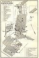
 Wiblingen Härnösand.png 2,359 × 2,051; 5.44 MB


