Category:Old maps of Guangdong
Jump to navigation
Jump to search
Subcategories
This category has the following 6 subcategories, out of 6 total.
C
- Old maps of Chaozhou (2 F)
G
J
- Old maps of Jiangmen (4 F)
O
- Old maps of Pearl River (21 F)
S
- Old maps of Shantou (13 F)
Media in category "Old maps of Guangdong"
The following 146 files are in this category, out of 146 total.
-
 恩州.png 368 × 365; 321 KB
-
 Da Ming yu di tu LOC 2002626776-15.jpg 9,580 × 9,042; 13.84 MB
-
 Da Ming yu di tu LOC 2002626776-15.tif 9,580 × 9,042; 247.83 MB
-
 Guang yu tu - er juan LOC 2008623187-30.jpg 4,320 × 4,658; 4.54 MB
-
 Guang yu tu - er juan LOC 2008623187-30.tif 4,320 × 4,658; 57.57 MB
-
 Guang Yutu 1558 Vol 1 Pg 47 Guangdong 1.jpg 4,380 × 4,658; 4.04 MB
-
 Fen ye yu tu. LOC 2002626777-16.jpg 4,272 × 5,080; 1.9 MB
-
 Fen ye yu tu. LOC 2002626777-16.tif 4,272 × 5,080; 62.09 MB
-

-
 "Quantung, Imperii Sinarum provincia duodecima" (22240445622).jpg 3,598 × 3,006; 2.12 MB
-
 Qvantvng - Atlas Maior, vol 11, map 24 - Joan Blaeu, 1667 - BL 114.h(star).11.(24).jpg 4,000 × 3,351; 1.93 MB
-
 Atlas Van der Hagen-KW1049B13 048-QVANTVNG, IMPERII SINARVM PROVINCIA DVODECIMA.jpeg 5,500 × 4,620; 3.12 MB
-

-

-
 Der Jesuiten-Atlas der Kanghsi-Zeit - China und die Aussenlaender LOC 74650033-31.jpg 9,669 × 8,228; 8.69 MB
-
 Der Jesuiten-Atlas der Kanghsi-Zeit - China und die Aussenlaender LOC 74650033-31.tif 9,669 × 8,228; 227.61 MB
-
 Kouang-Toung - par Jean-Baptiste d'Anville - btv1b53009299t.jpg 6,495 × 5,141; 5.62 MB
-

-
 Province de Quang-Tong - (tirée du P. Duhalde) - btv1b85951154.jpg 10,496 × 7,978; 12.95 MB
-

-
-
 Province du Quang-tong (French map of Guangdong Province, China, 1735).jpg 5,700 × 4,308; 3.41 MB
-
 AnNamGiang1735-1740-1839.jpg 2,280 × 1,080; 1.12 MB
-
 Anville Nouvel atlas de la Chine - Page46 quang tong.jpg 4,600 × 3,720; 5.83 MB
-

-
 Da Qing fen sheng yu tu LOC 2002626726-16.jpg 5,296 × 4,515; 2.26 MB
-
 Da Qing fen sheng yu tu LOC 2002626726-16.tif 5,296 × 4,515; 68.41 MB
-
-

-

-
 Zhi li ge sheng yu di quan tu - Zhang Zongjing - btv1b53103898v (33 of 69).jpg 5,137 × 4,427; 2.83 MB
-

-

-
 Guangdong quan tu LOC gm71005120.jpg 13,026 × 10,962; 17.63 MB
-
 Hunan Guangdong he tu. LOC gm71005129.jpg 9,297 × 9,186; 8.78 MB
-
 Hunan Guangdong he tu. LOC gm71005129.tif 9,297 × 9,186; 244.34 MB
-
 Dian Yue Yuenan lian jie yu tu. LOC gm71005069.jpg 5,137 × 7,267; 4.78 MB
-
 Dian Yue Yuenan lian jie yu tu. LOC gm71005069.tif 5,137 × 7,267; 106.8 MB
-
 Nan yang fen tu. LOC gm71005139.jpg 5,100 × 7,186; 5.22 MB
-
 Nan yang fen tu. LOC gm71005139.tif 5,100 × 7,186; 104.85 MB
-
 Huang chao zhi sheng di yu quan tu - btv1b531099218 (21 of 38).jpg 6,177 × 4,548; 3.81 MB
-

-
 Guangdong quan sheng shui lu yu tu LOC gm71005159.jpg 14,152 × 11,530; 22.07 MB
-
 Guangdong quan sheng shui lu yu tu LOC gm71005159.tif 14,152 × 11,530; 466.84 MB
-
 Tian xia zong yu tu. LOC 2002626780-17.jpg 3,865 × 3,150; 1.15 MB
-
 Tian xia zong yu tu. LOC 2002626780-17.tif 3,865 × 3,150; 34.83 MB
-
 Mission D'Exploration Commerciale en Chine 1895-97 -- Carte du Kouang-Si et Kouang Toung.jpg 8,857 × 5,409; 6.94 MB
-

-

-
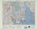
 STANFORD(1917) p15-16 PLATE 1. KWANGTUNG (14597113490).jpg 4,790 × 3,795; 8.54 MB
-
-
 1935 Guangdong sheng you.png 1,444 × 2,004; 6.48 MB
-
 1935 Guangdong sheng zuo.png 1,444 × 1,948; 6.94 MB
-

-
 328 of 'A Voyage to China' (11032243026).jpg 1,276 × 2,019; 645 KB
-
 Admiralty Chart No 1021 Tien-pe-hien Harbour and Gallong or Gelang Bay, Published 1779.jpg 2,936 × 3,964; 2.47 MB
-
 Admiralty Chart No 1022 Shitoe Bay, Island St. John, Published 1786.jpg 3,034 × 3,878; 1.88 MB
-
 Admiralty Chart No 1023 Plan of Tong-Hou Cove, with Directions, Published 1799.jpg 3,038 × 3,974; 2.87 MB
-

-
 Admiralty Chart No 1962 Hong Kong to the Brothers, Published 1966.jpg 21,661 × 11,213; 66.78 MB
-
-
 Admiralty Chart No 1962 Hongkong to the Brothers, Published 1890 webp.webp 15,719 × 4,094; 159.87 MB
-

-

-
 AMH-5648-KB Map of Guandong, China.jpg 2,400 × 1,990; 650 KB
-
 AMH-5649-KB Map depicting the journey by Joan Nieuhoff from Canton to Peking.jpg 2,400 × 2,024; 682 KB
-
 AMH-6662-KB Map of China.jpg 1,940 × 2,400; 1.06 MB
-
 AMH-6721-KB Map of China and Korea.jpg 2,400 × 2,187; 1,001 KB
-
 Canton estuary 2.jpg 3,595 × 3,181; 6.81 MB
-
 Canton estuary.jpg 3,595 × 3,181; 1.14 MB
-
 CANTON RIVER AND ADJACENT ISLANDS from Google Book.jpg 4,887 × 4,661; 2.24 MB
-
 CANTON RIVER AND ADJACENT ISLANDS, 2nd ed.jpg 2,468 × 2,355; 963 KB
-
 Canton River and adjacent islands.jpg 4,952 × 4,695; 5.44 MB
-
 Canton Thirteen Factories map 1748-49 enhanced with translations.jpg 3,578 × 2,613; 4.73 MB
-
 Canton Thirteen Factories map 1748-49 original.jpg 3,578 × 2,133; 2.7 MB
-
 Canton to Bocca Tigris.jpg 2,580 × 1,442; 1.69 MB
-
 Canton town map 1748-49 enhanced with translations.jpg 3,586 × 3,614; 8.01 MB
-
 Canton town map 1748-49 original.jpg 3,586 × 2,105; 3.85 MB
-
 Carte des îles Formose (34167570590).jpg 1,200 × 1,028; 624 KB
-
 Chart of the Canton River.jpg 2,484 × 2,324; 264 KB
-
 Situationskärtchen von Kanton, Makao, Hongkong.jpg 966 × 1,233; 207 KB
-
 Die Chinesische Küste Der Provinz Kuang-tung.jpg 11,855 × 8,522; 14.87 MB
-
 EB9 China.png 2,754 × 3,531; 14.21 MB
-
 Fatshan Map.jpg 10,348 × 7,916; 13.04 MB
-
 HK CAN MO 1945.jpg 10,096 × 7,984; 12.13 MB
-
 Kwangtung and Canton 1878.jpg 1,716 × 2,809; 961 KB
-
 Kwangtung Canton Hainan Island Map.jpg 11,520 × 8,496; 18.49 MB
-
 Map of Canton and vicinity, 1904.png 2,881 × 2,272; 9.8 MB
-
 Map of Canton River.jpg 1,732 × 1,509; 266 KB
-
 Map of Guangdong Province, China, 1889.jpg 3,942 × 2,688; 2.22 MB
-
 Maps Kwangtung Pearl River Delta.tif 3,518 × 2,666; 26.86 MB
-
 Meyers b9 s0474 b2.png 383 × 494; 102 KB
-
 Mission du Kouang-tong.jpg 2,362 × 1,473; 3.6 MB
-
 New Atlas of China, Chinese Tartary and Tibet WDL167.png 1,253 × 1,024; 2.54 MB
-
 Paradigma XV Provinciarum &c.png 2,543 × 2,700; 14.45 MB
-
 Pas-Kaart van het in- en opkomen van de Rivier van Quantong.jpg 3,549 × 3,095; 4.92 MB
-
 Pearl River Entrance 1922.jpg 13,216 × 12,000; 18.01 MB
-
 Pearl River sketch.jpg 1,131 × 1,672; 1.14 MB
-
 Quantung,Fokien (Coronelli Map of Hong Kong, Formosa).jpg 2,015 × 1,428; 686 KB
-
 River and Port of Canton.jpg 1,841 × 1,027; 261 KB
-
 Sanon.png 649 × 530; 758 KB
-
 Suiwuicitymap1840.JPG 1,600 × 1,042; 673 KB
-
 Szeyap.png 340 × 360; 268 KB
-
 The Canton River.tif 4,035 × 2,230; 25.76 MB
-
 The Macao - Bocca Tigris - Canton approach.jpg 898 × 1,046; 773 KB
-
 Txu-oclc-10552568-nf49-10.jpg 5,000 × 3,860; 5.97 MB
-
 Txu-oclc-10552568-nf49-11.jpg 5,000 × 3,818; 5.46 MB
-
 Txu-oclc-10552568-nf49-12.jpg 5,000 × 3,814; 4.64 MB
-
 Txu-oclc-10552568-nf49-14.jpg 5,000 × 3,839; 5.1 MB
-
 Txu-oclc-10552568-nf49-8.jpg 5,000 × 3,855; 6.15 MB
-
 Txu-oclc-10552568-nf50-2.jpg 5,000 × 3,792; 6.11 MB
-
 Txu-oclc-10552568-nf50-3.jpg 5,000 × 3,783; 4.89 MB
-
 Txu-oclc-10552568-nf50-6.jpg 5,000 × 3,824; 4.85 MB
-
 Txu-oclc-10552568-Zhanjiang-full.png 4,525 × 5,300; 60.44 MB
-
 Z . Pratical map of Kwangtung province - btv1b531955556.jpg 11,838 × 8,512; 16.55 MB
-
 七省沿海圖-新安至陽江.png 2,748 × 1,024; 4.17 MB
-
 亚新地学社1936年《袖珍中华全图》--15广东省.jpg 2,150 × 1,540; 797 KB
-
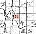
 勤州.png 836 × 721; 55 KB
-
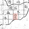 南恩州.png 754 × 765; 48 KB
-
 封州.png 685 × 664; 46 KB
-
 广东舆地全图1.jpg 870 × 830; 473 KB
-
 康州.png 686 × 644; 42 KB
-
 康熙内府分省分府圖 廉州府圖.jpg 2,400 × 1,971; 815 KB
-
 康熙内府分省分府圖 廣東全圖.jpg 2,400 × 1,971; 1.02 MB
-
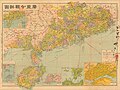
 廣東.png 2,888 × 2,016; 14.08 MB
-
 廣東分縣詳圖-亞光與地學社-1947.jpg 8,720 × 6,536; 8.32 MB
-
 廣東省明細全圖-上海商務印書館-1924.jpg 18,317 × 12,310; 32.05 MB
-
 循州.png 1,344 × 878; 93 KB
-
 新安縣志香港海防圖, 1819.png 1,000 × 694; 1.27 MB
-
 新州.png 695 × 649; 37 KB
-
 春州.png 707 × 713; 42 KB
-
 最新廣東分縣詳圖-香港書業公會-1948.jpg 13,030 × 9,593; 19.5 MB
-
 最新廣東省明細大地圖-東方與地學社-1940.jpg 5,143 × 3,740; 5.97 MB
-
 武備志 茅元儀 明朝 地圖 37.jpg 1,395 × 975; 267 KB
-
 武備志 茅元儀 明朝 地圖 38.jpg 1,403 × 973; 238 KB
-
 海不揚波圖(海豐).jpg 4,592 × 2,584; 6.6 MB
-
 潘州.png 714 × 647; 42 KB
-
 潮陽海防圖.jpg 1,165 × 787; 457 KB
-
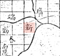
 瀧州.png 695 × 744; 49 KB
-
 皇清地理圖八十一及八十二.jpg 4,096 × 3,463; 2.68 MB
-
 禹跡圖中之泿水.png 3,393 × 2,199; 1.4 MB
-
 竇州.png 641 × 672; 43 KB
-
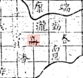
 端州.png 818 × 777; 56 KB
-
 英州.png 963 × 870; 73 KB
-
 韶州.png 912 × 820; 62 KB
-
 高州.png 690 × 649; 41 KB


_;_excudit_Joannes_Blaeu_-_btv1b85951139.jpg)
.jpg)
.11.(24).jpg)

.jpg)
.jpg)


_-_Delahaye_sculpsit_-_btv1b8492942m.jpg)
_-_btv1b85951154.jpg)
_-_(tir%C3%A9e_du_P._Duhalde)_;_Delahaye_sculpsit_;_D._Sornique_sculp._-_btv1b8595114q.jpg)
_-_Delahaye_sculpsit_-_btv1b53058172p.jpg)
.jpg)


.jpg)


.jpg)
.jpg)


.jpg)
.jpg)


_-_btv1b531955662.jpg)
_p15-16_PLATE_1._KWANGTUNG_(14597113490).jpg)


.jpg)
.jpg)


.jpg)


.jpg)


