Category:Old maps of Grue
Jump to navigation
Jump to search
Media in category "Old maps of Grue"
The following 15 files are in this category, out of 15 total.
-
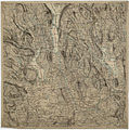
 Hedmarkens amt nr 29- Geometrisk Delekart over Gaardene Sorknæs (to kart; 29 og 29b), Grue, 1804.jpg 7,028 × 13,233; 13.96 MB
-

-
 Kvadratmilkart Mil nr 111-nø-sø, 1790.jpg 7,287 × 14,972; 18.52 MB
-
 Kvadratmilkart Mil nr 123-nv-sv, 1790.jpg 7,237 × 14,538; 18.17 MB
-
 Kvadratmilkart Mil nr 124-nv-sv, 1790.jpg 7,504 × 14,739; 18.72 MB
-
 Kvadratmilkart Mil nr 132-nv-sv, 1801.jpg 7,320 × 14,739; 15.86 MB
-
 Kvadratmilkart Mil nr 134-nv-sv, 1790.jpg 7,453 × 14,622; 19.56 MB
-
 Kvadratmilkart Mil nr 144-nv-sv, 1795.jpg 7,486 × 14,889; 16.37 MB
-
 Kvadratmilkart Mil nr 145-nv-sv, 1796.jpg 7,420 × 14,706; 15.25 MB
-
 Kvadratmilkart Mil nr 146-nv-sv, 1796.jpg 7,519 × 14,689; 17.85 MB
-
 Portefølje nr 32-1, 1860.jpg 6,920 × 6,935; 10.68 MB
-
 Portefølje nr 32-2, 1860.jpg 7,087 × 7,087; 11.02 MB
-
 Portefølje nr 32-3, 1860.jpg 6,872 × 6,935; 9.3 MB
-
 Portefølje nr 33-1, 1860.jpg 6,904 × 6,887; 8.31 MB
-
 Portefølje nr 33-2, 1860.jpg 6,831 × 6,847; 8.36 MB
,_Grue,_1804.jpg)
,_Grue,_1804.jpg)


