Category:Old maps of Gorée
Jump to navigation
Jump to search
Media in category "Old maps of Gorée"
The following 23 files are in this category, out of 23 total.
-

-
 A plan of the Island of Goree. LOC 2019589112.jpg 4,409 × 5,338; 3.38 MB
-
 A plan of the Island of Goree. LOC 2019589112.tif 4,409 × 5,338; 67.34 MB
-
 AMH-6755-NA Map of the island of Goeree.jpg 2,400 × 1,711; 499 KB
-
 AMH-7888-KB Map of the island of Goeree.jpg 2,400 × 1,794; 788 KB
-
 AMH-7889-KB Bird's eye view of Goeree.jpg 2,400 × 1,405; 705 KB
-
 AMH-8132-KB Map in bird's eye prospect of the island of Goeree.jpg 2,400 × 1,469; 608 KB
-
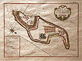
 AMH-8133-KB Floor plan of the fort on Goeree.jpg 2,400 × 2,004; 808 KB
-
 AMH-8166-KB Map of Cape Verde and view of Goeree.jpg 1,774 × 2,400; 576 KB
-
 Carte de l'île de Gorée en 1784.jpg 1,294 × 967; 745 KB
-
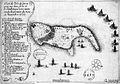
 French capture of Goree over the Dutch in 1677.jpg 1,357 × 1,030; 275 KB
-
 Gorée 1745-47.jpg 723 × 309; 66 KB
-
 Gorée-1786.jpg 710 × 521; 230 KB
-
 Gorée1677.jpg 1,276 × 894; 565 KB
-
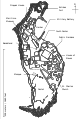
 GoréeMap2.jpg 768 × 346; 127 KB
-
 Grundriss von dem Eylande Gorèe.jpg 940 × 597; 212 KB
-

-
 L'Isle de Gore Schley 1772.jpg 1,300 × 969; 1.76 MB
-
 Map of Goree.svg 400 × 582; 1.28 MB
-
 Plan de l'Ile de Gorée avec ses fortifications mg 8501.jpg 3,505 × 2,626; 2.14 MB
-
 Plan du combat de l'île de Gorée en 1677.jpg 1,944 × 1,219; 861 KB
-

-
 Atlas national portatif de la France 1792 (105094065).jpg 10,970 × 5,733; 10.72 MB


.jpg)


.jpg)