Category:Old maps of Gloucester
Jump to navigation
Jump to search
Subcategories
This category has only the following subcategory.
G
Media in category "Old maps of Gloucester"
The following 17 files are in this category, out of 17 total.
-
 Ancient Gloucester from Speed's map of 1610 and Hall & Pinnell, ex Fosbroke.jpg 5,806 × 4,629; 3.23 MB
-
 Glocester (BM 1868,0822.5929).jpg 2,305 × 2,230; 1.16 MB
-
 Glocester (BM 1868,0822.5930).jpg 1,886 × 2,200; 999 KB
-
 Glocester (BM 1882,0114.161).jpg 2,017 × 2,500; 940 KB
-
-

-
 10 of 'The History and Antiquities of Gloucester, etc' (11003101465).jpg 2,396 × 3,104; 1.65 MB
-
 St Luke's Church, High Orchard, Gloucester c. 1880.jpg 3,228 × 4,278; 3.49 MB
-
 Gloucester Albert Hall, Shire Hall, Corn Exchange Ordnance Survey map 1880s.jpg 9,420 × 5,860; 23.53 MB
-
 Tredworth Road Cemetery 1884 OS.jpg 560 × 553; 118 KB
-

-
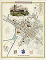
 Causton’s 1843 map of Gloucester.jpg 3,300 × 2,550; 1.78 MB
-
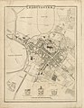
 Hall and Pinnell map of Gloucester 1780.jpg 3,299 × 2,930; 3.69 MB
-
 High Orchard, Gloucester, Ordnance Survey map 1880s (2).jpg 9,410 × 5,830; 10.36 MB
-
 High Orchard, Gloucester, Ordnance Survey map 1880s.jpg 6,243 × 9,014; 9.76 MB
-
 High Orchard, Gloucester, Ordnance Survey map c.1900.jpg 6,200 × 9,029; 16.48 MB
-
 Westgate Street, Gloucester, c.1900 Ordnance Survey map.jpg 9,460 × 5,860; 15.61 MB

.jpg)
.jpg)
.jpg)

_drawn_and_engraved_under_the_direction_of_Edward_Wedlake_Brayley.jpg)
.jpg)


.jpg)


.jpg)


