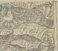
Category:Old maps of Gilgit-Baltistan
Jump to navigation
Jump to search
Media in category "Old maps of Gilgit-Baltistan"
The following 3 files are in this category, out of 3 total.
-
Alignment Official Pakistan map 1962.jpg 600 × 616; 59 KB
-
Darel-Tangir-Chilas.png 1,581 × 1,403; 4.76 MB
-
Jammu and Kashmir in 1946 map of India by National Geographic.jpg 1,551 × 1,209; 429 KB


