Category:Old maps of Germany 1919-1937 (Stielers Handatlas)
Jump to navigation
Jump to search
Media in category "Old maps of Germany 1919-1937 (Stielers Handatlas)"
The following 10 files are in this category, out of 10 total.
-
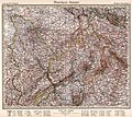
 (Stielers Handatlas, 1925 - map 6) Germany 1919-1937, Deutschland. Germany.jpg 8,193 × 7,421; 12.33 MB
-
 (Stielers Handatlas, 1925 - map 7) Germany 1919-1937, Schleswig-Holstein - Mecklenburg.jpg 8,345 × 7,394; 11.2 MB
-
 (Stielers Handatlas, 1925 - map 8) Germany 1919-1937, Pommern. Pomerania.jpg 8,377 × 7,394; 11.55 MB
-
 (Stielers Handatlas, 1925 - map 9) Germany 1919-1937, Ostpreußen. East Prussia.jpg 6,951 × 9,105; 10.9 MB
-

-
-
 (Stielers Handatlas, 1925 - map 12) Germany 1919-1937, Mitteldeutschland. Central Germany.jpg 8,359 × 7,394; 13.01 MB
-
 (Stielers Handatlas, 1925 - map 13) Germany 1919-1937, Schlesien. Silesia.jpg 8,381 × 7,412; 12.24 MB
-

-
 (Stielers Handatlas, 1925 - map 15) Germany 1919-1937, Bayern. Bavaria.jpg 8,398 × 7,448; 12.97 MB
_Germany_1919-1937,_Deutschland._Germany.jpg)
_Germany_1919-1937,_Schleswig-Holstein_-_Mecklenburg.jpg)
_Germany_1919-1937,_Pommern._Pomerania.jpg)
_Germany_1919-1937,_Ostpreu%C3%9Fen._East_Prussia.jpg)
_Germany_1919-1937,_Oldenburg_-_Hannover_-_Westfalen._Hanover_-_Westphalia.jpg)
_Germany_1919-1937,_Rheinland_-_Hessen._Rhineland_-_Hessen.jpg)
_Germany_1919-1937,_Mitteldeutschland._Central_Germany.jpg)
_Germany_1919-1937,_Schlesien._Silesia.jpg)
_Germany_1919-1937,_S%C3%BCdwestdeutschland._South-Western_Germany.jpg)
_Germany_1919-1937,_Bayern._Bavaria.jpg)