Category:Old maps of Gennep
Jump to navigation
Jump to search
Subcategories
This category has only the following subcategory.
M
Media in category "Old maps of Gennep"
The following 15 files are in this category, out of 15 total.
-
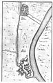
 Gennep 1649 Blaeu Arcis.jpg 750 × 580; 239 KB
-
 TrK8-Gennep B1.jpg 4,438 × 3,294; 14.09 MB
-
 TrK8-Gennep B2.jpg 4,571 × 3,259; 14.7 MB
-
 Befästningsplan vid del av floden Maas vid orten Gennep, 1641 - Skoklosters slott - 99053.tif 4,597 × 3,574, 2 pages; 47.03 MB
-

-
 De merian Westphaliae 115.jpg 1,920 × 2,988; 1.4 MB
-
 Gennep 1650 Blaeu ¿.jpg 8,565 × 6,405; 5.8 MB
-
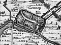
 Genneperhuis.jpg 425 × 319; 127 KB
-
 Plattegrond naar Blaeu - Gennep - 20077315 - RCE.jpg 1,200 × 877; 310 KB
-

-

-
 TrK8-Gennep A1.jpg 4,471 × 3,264; 14.54 MB
-
 TrK8-Gennep A2.jpg 4,524 × 2,992; 13.71 MB
-
 TrK8-Gennep C1.jpg 4,449 × 2,651; 11.38 MB
-
 TrK8-Gennep C2.jpg 4,607 × 2,758; 9.04 MB


.jpg)


