Category:Old maps of Fourni
Jump to navigation
Jump to search
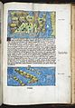
English: Until the 18th century, Fourni (Forni, Fornoli, etc) was located at wrong places in sea maps, see Category:Old maps of Dipso, Crusia, Tragia, Forni, Mandria. This category is dedicated old maps without such errors, for example showing Fourni alone, or old maps of newer dates.
Media in category "Old maps of Fourni"
The following 5 files are in this category, out of 5 total.
-
 Buendelmonti Arcipelagi 30r.jpg 2,092 × 1,533; 589 KB
-
 Liber Insularum Cycladum (Arundel MS 93.art.7, f.149r).jpeg 5,513 × 7,936; 51.38 MB
-
 Map of Fournoi - Roux Joseph - 1804.jpg 1,500 × 1,053; 608 KB
-

-
 Admiralty Chart No 1568 Ports and anchorages in the eastern Aegean Sea, Published 1960.jpg 11,260 × 8,283; 31.73 MB

.jpeg)


