Category:Old maps of Eibenstock
Jump to navigation
Jump to search
Subcategories
This category has the following 4 subcategories, out of 4 total.
B
- Old maps of Blauenthal (4 F)
O
- Old maps of Neues Wiesenhaus (6 F)
- Old maps of Wilzschmühle (8 F)
Media in category "Old maps of Eibenstock"
The following 34 files are in this category, out of 34 total.
-

-

-
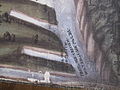
 Eibenstock Carlsfeld Bergrevier Bildkarte von 1520 1.jpg 1,761 × 1,675; 418 KB
-
 Eibenstock Carlsfeld Bergrevier Bildkarte von 1520 10.jpg 4,000 × 3,000; 3.58 MB
-
 Eibenstock Carlsfeld Bergrevier Bildkarte von 1520 11.jpg 4,000 × 3,000; 3.55 MB
-
 Eibenstock Carlsfeld Bergrevier Bildkarte von 1520 12.jpg 4,000 × 3,000; 3.69 MB
-
 Eibenstock Carlsfeld Bergrevier Bildkarte von 1520 13.jpg 4,000 × 3,000; 3.28 MB
-
 Eibenstock Carlsfeld Bergrevier Bildkarte von 1520 14.jpg 4,000 × 3,000; 3.42 MB
-
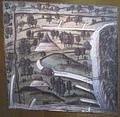 Eibenstock Carlsfeld Bergrevier Bildkarte von 1520 2.jpg 2,919 × 2,858; 1.06 MB
-
 Eibenstock Carlsfeld Bergrevier Bildkarte von 1520 3.jpg 4,000 × 3,000; 3.24 MB
-
 Eibenstock Carlsfeld Bergrevier Bildkarte von 1520 4.jpg 3,000 × 4,000; 3.14 MB
-
 Eibenstock Carlsfeld Bergrevier Bildkarte von 1520 5.jpg 4,000 × 3,000; 3.42 MB
-
 Eibenstock Carlsfeld Bergrevier Bildkarte von 1520 6.jpg 4,000 × 3,000; 3.35 MB
-
 Eibenstock Carlsfeld Bergrevier Bildkarte von 1520 7.jpg 4,000 × 3,000; 3.62 MB
-
 Eibenstock Carlsfeld Bergrevier Bildkarte von 1520 8.jpg 4,000 × 3,000; 3.12 MB
-
 Eibenstock Carlsfeld Bergrevier Bildkarte von 1520 9.jpg 4,000 × 3,000; 3.35 MB
-
-

-

-
 Forsthaus beim Ochsenkopfe.jpg 1,043 × 459; 117 KB
-
 Karte Westerzgebirge Maßstab 1 zu 100000 ca 1900.jpg 5,841 × 6,714; 19.29 MB
-
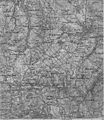
 Karte westliches Erzgebirge Vogtland.jpg 3,416 × 5,313; 8.5 MB
-
 Meilenblatt B 220 Morgenröthe.jpg 8,990 × 9,020; 29.15 MB
-
 Meilenblatt B 221 Eibenstock.jpg 8,980 × 9,050; 28.89 MB
-
 Meilenblatt B 222 Bockau.jpg 8,990 × 9,020; 29.75 MB
-
 Meilenblatt B 246 Weitersglashütte.jpg 9,030 × 9,030; 17.99 MB
-
 Meilenblatt B 247 Johanngeorgenstadt.jpg 9,040 × 9,020; 27.06 MB
-
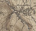
 Pechhütte westlich der Wilzsch Sächs. Meilenblätter Berlin-Ex. Blatt 220 von 1791.jpg 1,215 × 1,024; 332 KB
-
-
 Schneeberg Aue Schwarzenberg Ausschnitt Karte von Hiob Magdeburg von 1566.jpg 1,223 × 782; 222 KB
-

-

-

-

_von_1791_(Ausschnitt).jpg)


_aus_dem_Jahr_1876_Ausschnitt.jpg)


