Category:Old maps of Dieppe
Jump to navigation
Jump to search
Media in category "Old maps of Dieppe"
The following 4 files are in this category, out of 4 total.
-

-
 Admiralty Chart No 2147 River Durdent to Cayeux, Published 1894, Large Corrections 1951.jpg 16,247 × 11,066; 17.06 MB
-
 Dieppe 1589.jpg 1,460 × 800; 429 KB
-
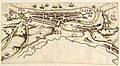
 Plan du port de Dieppe en 1600. Plan d'Etretat - btv1b84391498.jpg 6,514 × 4,605; 4.63 MB
_-_dessin%C3%A9s_par..._-_btv1b52503974g_(029_of_106).jpg)


