Category:Old maps of Democratic Republic of Georgia
Jump to navigation
Jump to search
Media in category "Old maps of Democratic Republic of Georgia"
The following 11 files are in this category, out of 11 total.
-
 1918 map of the Caucasus by the British Army.jpg 6,076 × 7,403; 6.44 MB
-
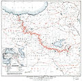 Boundary between Turkey and Armenia as determined by Woodrow Wilson.jpg 8,953 × 8,820; 42.55 MB
-
 Carte de la Georgie, 1920.jpg 794 × 533; 207 KB
-
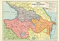
 Democratic Republic of Georgia 1919 map in pamphlet of Georgian National Committee.jpg 2,000 × 1,374; 456 KB
-
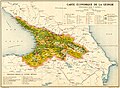 Economy of Democratic Republic of Georgia (1918).jpg 3,276 × 2,409; 2.08 MB
-
 Map of Georgia 1919.jpg 828 × 518; 197 KB
-
 Map of the Democratic Republic of Georgia to the Paris Peace Conference.png 3,160 × 2,051; 9.45 MB
-
 Treaty of Sèvres &Soviet Republics of Transcaucasia.jpg 1,190 × 830; 1.16 MB
-
 Treaty of Sèvres &SovietRepublics of Transcaucasia.jpg 1,647 × 1,182; 821 KB
-
 Фрагмент карты Грузии И.Джавахишвили. 1919 г.jpg 372 × 520; 49 KB
-
 საქართველოს საზღვრების რუკა 1919.jpg 1,140 × 827; 239 KB


.jpg)


