Category:Old maps of Cromartyshire
Jump to navigation
Jump to search
Traditional counties (shires) of Scotland: Aberdeenshire · Angus · Argyll ≈ Argyllshire · Ayrshire · Banffshire · Berwickshire · Buteshire · Caithness · Clackmannanshire · Cromartyshire · Dumbartonshire · Dumfriesshire · East Lothian · Fife · Inverness-shire · Kincardineshire · Kinross-shire · Kirkcudbrightshire · Lanarkshire · Midlothian · Moray · Nairnshire · the Orkney Islands ≈ Orkney Islands · Peeblesshire · Perthshire · Renfrewshire · Ross-shire · Roxburghshire · Selkirkshire · the Shetland Islands ≈ Shetland Islands · Stirlingshire · Sutherland · West Lothian · Wigtownshire
Subcategories
This category has only the following subcategory.
Media in category "Old maps of Cromartyshire"
The following 5 files are in this category, out of 5 total.
-
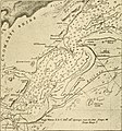 The earth and its inhabitants (1881) (14597757608).jpg 1,856 × 1,988; 666 KB
-
-

-
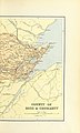
 Cromartyshire 1892.jpg 1,243 × 729; 537 KB
-
 Plan of the Barony of Castle Leod, Published 1796.jpg 6,069 × 4,136; 6 MB
_(14597757608).jpg)
.jpg)
.jpg)

