Category:Old maps of Concord, Massachusetts
Jump to navigation
Jump to search
Subcategories
This category has only the following subcategory.
Media in category "Old maps of Concord, Massachusetts"
The following 20 files are in this category, out of 20 total.
-
-

-

-

-

-

-

-
 Map of the town of Concord (3856488100).jpg 9,032 × 6,960; 10.69 MB
-
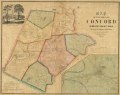
 Map of the town of Concord, Middlesex County Mass. LOC 2012593522.jpg 9,414 × 7,452; 9.21 MB
-
 Map of the town of Concord, Middlesex County Mass. LOC 2012593522.tif 9,414 × 7,452; 200.71 MB
-
 Map of Concord, Mass., 1852.tif 7,886 × 6,258; 141.21 MB
-
 Massachusetts Encampment, Concord, September 7, 8, and 9, 1859 (2673784191).jpg 1,977 × 2,000; 3.58 MB
-
 Centennial map of Concord, 1775-1875 (3369692455).jpg 2,000 × 1,336; 2.46 MB
-

-
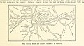
 Trolley trips through New England (1900) (14779543122).jpg 1,744 × 1,280; 326 KB
-

-

-

-

-

.jpg)


_the_line_as_chartered_and_the_line_as_located_(9472266423).jpg)

.jpg)

.jpg)
.jpg)
.jpg)
_(14779543122).jpg)
.jpg)


